

Tornadoes on radar: How meteorologists see them
MILWAUKEE (WITI) -- For a meteorologist, it’s a never ending endeavor, trying to provide lead time to oncoming tornadoes without crying wolf at every storm. Fortunately, advancements in radar technology have given meteorologists the upper hand in this fight.
The current network of National Weather Service radars were developed in the late 80s and installed in the 90s. They are the first group of Doppler radars which can detect motion within a storm. One by one, these aging radars have been receiving a huge technological upgrade starting in 2010.
The old radars can now do new tricks with “dual polarization”. Instead of simply detecting precipitation and motion like any doppler radar, they can better detect rain vs. snow vs. hail vs. debris from a tornado.
REFLECTIVITY
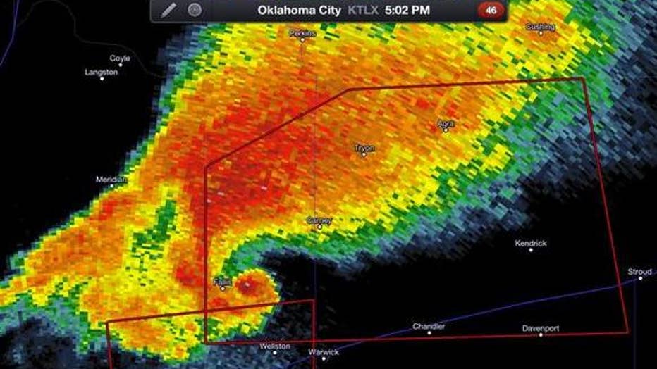
The image above shows what you typically see from radar. “Reflectivity” basically shows how much stuff the radar is picking up. Light rain bounces back a small return, heavy rain a larger return, and rain with hail a very strong radar return indicated by red or purple shading on a map.
The hook shape on the southwest edge of the storm shows where the heavy rain and hail are wrapping around something. That something is a developing tornado. But in a reflectivity image a meteorologist still cannot tell if that tornado will fully develop, or if it’s already on the ground.
VELOCITY
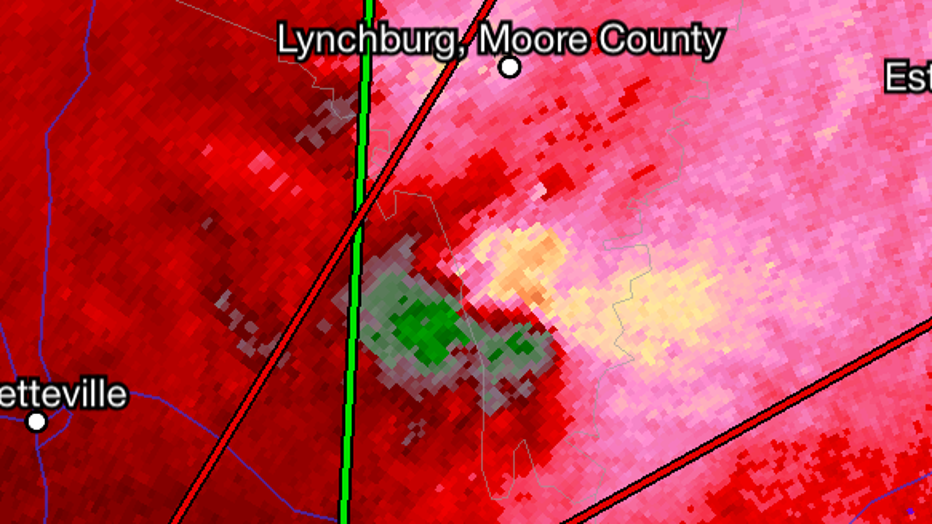
Here’s where the Doppler part of the radar comes in handy. The signal bouncing off a storm has a different frequency if it bounces off something moving towards or away from the radar. Thus, the radar can detect which part of the storm is moving towards or away from the radar site (along with its speed).
The image above displays fast winds moving away (pink) right next to fast winds moving towards (green) the radar which is southeast of the pink-green “couplet”. This is a strong indicator of rotation. Not sure how? Picture this.
You lay a bicycle on its side, and spin the back tire. The top of the tire near the seat is spinning towards you while the bottom is moving away. The front and back edge are moving left to right or right to left but not necessarily spinning towards or away.
In a storm, Doppler radar can detect the parts moving towards and away but the left to right motion does not change the frequency of the radar signal returning. So only half the rotation is seen while the rest is interpreted.
CORRELATION COEFFICIENT
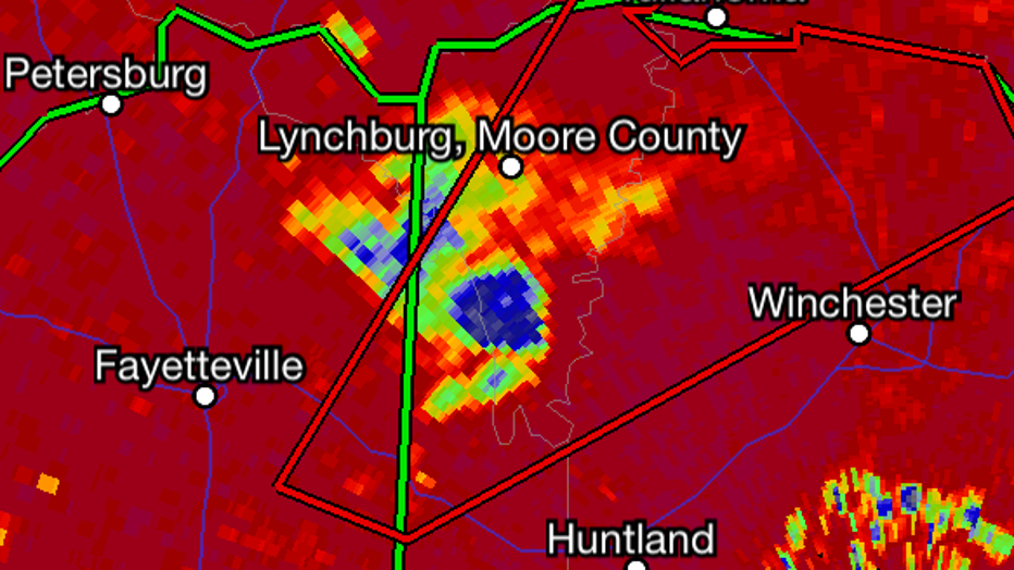
This is one of the new tools thanks to the dual polarization upgrade. NWS radars can detect if the objects the radar is bouncing off are the same size and shape. If they are all nearly the same (ie: small raindrops) the correlation coefficient or CC is close to 1. In a storm where rain is mixed with hail the radar is bouncing off different size objects so the CC drops below 1.
Finally if a tornado is on the ground, debris thrown high into the sky (branches, shingles, siding, cars, etc) show a wide range of sizes and shapes. The CC can drop to near 0 for powerful tornadoes.
The image above shows a likely tornado on the ground on April 28, 2014 in southern Tennessee. The red shows a CC of near 1 while the blue circle shows a much lower value due to the radar detecting debris from a tornado. This is also what a meteorologist may refer to as a “debris ball” on radar.
New technology used by meteorologists goes a long way in telling which storms have more bark than bite, and which ones pose a genuine threat to life and property. The result is longer lead times and fewer false alarms.