

Warmer than average temperatures expected this summer across most of the US
SOUTHEAST WISCONSIN -- The Climate Prediction Center, which is a branch of NOAA that specializes in long-term forecasts, is predicting a warmer than average summer with above-average precipitation for most of the United States.
One question you might have, is how can they make these forecasts so far out?
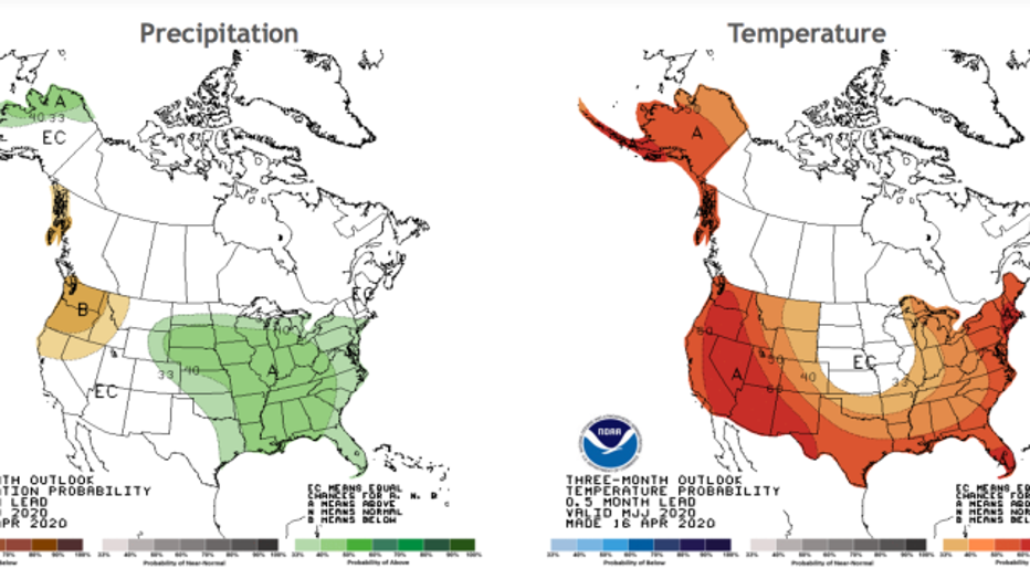
NOAA CPC forecast for temperature and precip for the Summer of 2020
When making long-range forecasts, looking at climate averages is key. One of the strongest predictors of seasonal temperatures and precip in the United States is based on Pacific Ocean surface temperatures. In the meteorology community, this key weather variable is called the El Nino Southern Oscillation or ENSO for short.
During seasons of warmer than average ocean surface temperatures in the eastern Pacific, we're in an El Nino pattern. During seasons of cooler than average ocean surface temperatures, we're in a La Nina pattern.
Neutral conditions are jokingly referred to as La Nada which is what we're in now and forecasted to continue into summer. Based on past years of neutral ENSO conditions, the CPC can forecast what we'll see for the summer of 2020. There will be local variations but based on climate averages they can accurately forecast most of the United States will be warmer than average and also receive more precipitation than average.
These forecasts aren't perfect but are based on historical data. This neutral pattern which we had during winter generally results in colder than average temps for Wisconsin and wetter/warmer than average conditions for the South. Was this 100% true? No, we were generally untouched by polar air this past Winter but the South did experience this pattern while farther North did see this bitter cold.
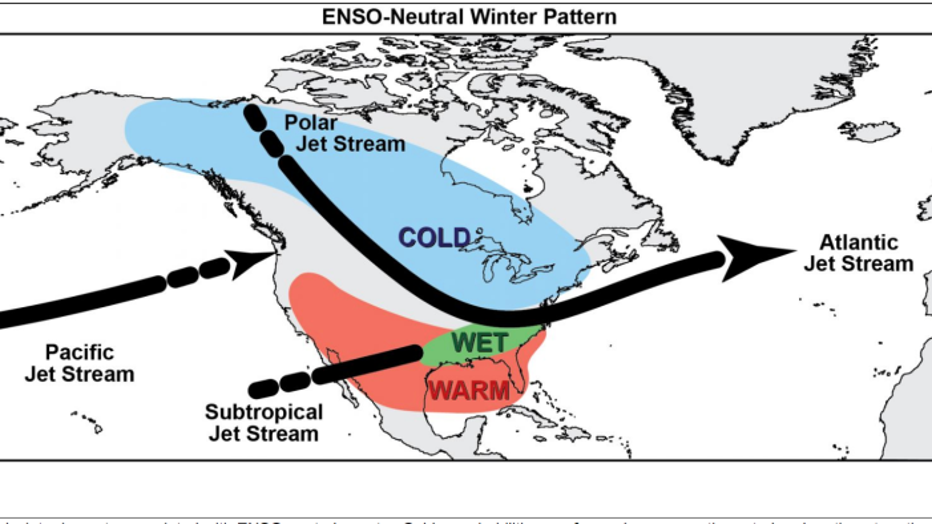
Typical weather averages during a Neutral ENSO Winter pattern
A key reason these forecasts are given in probabilities is because they're not expected to be right all the time. The percentages reflect how often warmer or cooler than average temps/precip occur given the current state of the ENSO and other weather variables. Factors that can influence this is sea ice extent in the northern hemisphere and how stable the polar air mass has been and is expected to be long term. Complicated right?
Below is an example of a model forecast based on current conditions. Each line you see is a variable that's tweaked to give a spread of expectations for how Pacific ocean temps will change by the end of summer. Looking all the way into November the general trend has cooler than average surface temps returning by Fall which puts us in a La Nina pattern.
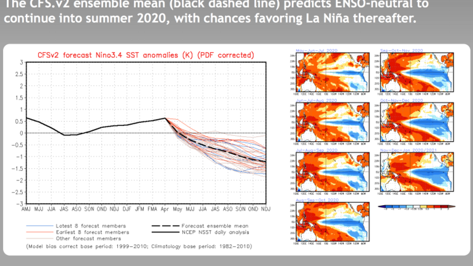
CPC model data forecasting long term ENSO patterns