

Spring thunderstorms arrive Wednesday night, bringing widespread rainfall
MILWAUKEE -- So far, most of May has been dry and cool, when it's typically one of our wettest months of the year, but finally, widespread rainfall arrives Wednesday night, May 13. Mostly starting as scattered light to moderate showers, the precipitation will become more intense, especially farther south, by early Thursday morning, May 14.
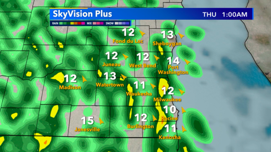
SkyVision Plus look at rain by tonight, May 14
The best chance for heavy rain will be in Illinois, but throughout southeast Wisconsin, periods of heavy rain is possible in the morning. Although gusty winds will be associated with heavy rain, our severe threat is very low.
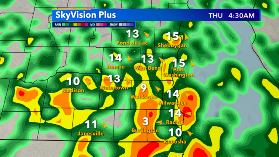
SkyVision Plus heavy shower forecast for early Thursday morning
Only a sliver of Wisconsin is included in a marginal risk for severe weather, meaning if we do see a severe storm, it will likely be isolated and short-lived.
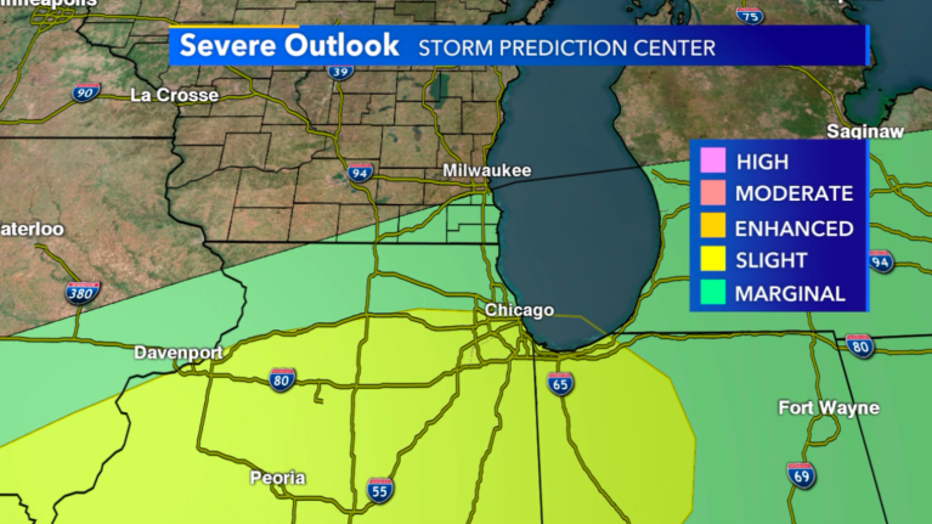
Severe outlook for May 14
Precip totals will range greatly, especially where the heaviest cells form up, but widespread half-inch to an inch is likely. Highest totals continue to be favored farther south in Illinois.
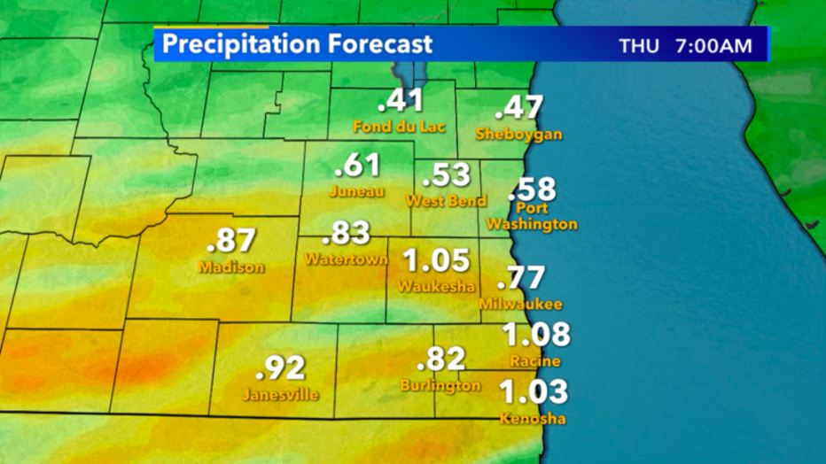
Precip forecast through May 14