

Scattered storms Thursday followed by cooler weather into next week
MILWAUKEE -- Throughout the day Thursday, May 28, a cold front will produce scattered storms, with the heaviest rain expected from Madison up to Eau Claire. Severe weather isn't a concern, but pockets of heavy rain are possible as this system moves through.
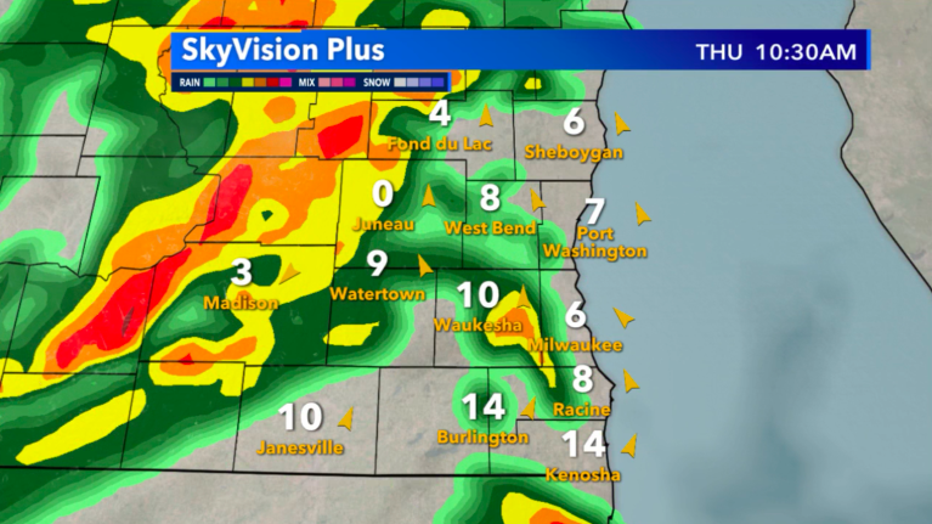
Skyvision Plus look at expected rain potential late morning, May 28
Rain won't be constant, but one of the noticeable changes will be a drop in the amount of moisture in the air, and temps back into the 60s after the front clears. Before Thursday, May 28, we had three straight 80˚+ high temps for the first time since mid-August 2019! That was over nine months ago.
We'll enter a stretch of 60s and 70s at least in the near future.
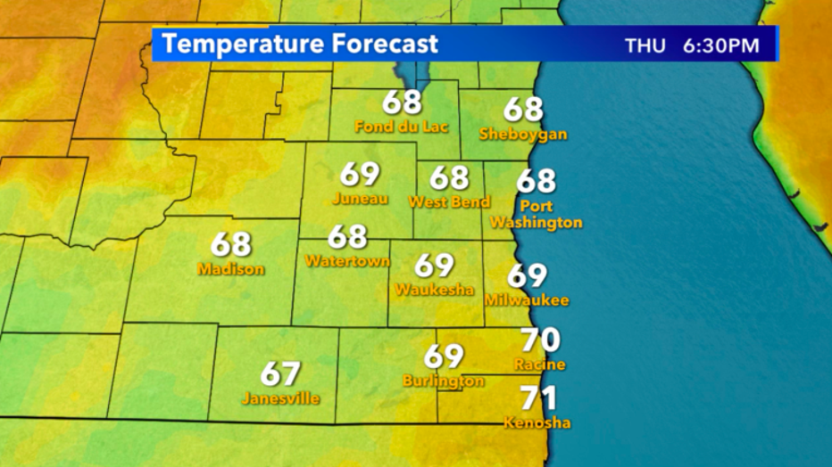
Temperature forecast for this evening, May 28
The 6-Day Planner has us shifting back to more seasonable conditions, as the average high this time of year is between 69˚-71˚ through the start of June. Long-term models favor a return to 80s by the end of next week.
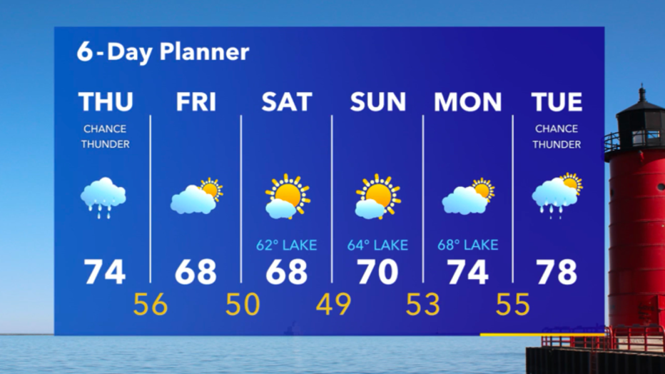
6-Day Planner for May 28-June 2