

Isolated afternoon showers and strong to severe storms possible Thursday evening
MILWAUKEE -- Pop up afternoon showers are possible Thursday, July 9, but the main concern is in the late afternoon, as a line of storms will develop along a cold front. Strong to severe storms are possible, but the most widespread impact you can expect is heavy rain.
Severe pockets in this line are possible, but it'll mostly be isolated or short-lived.
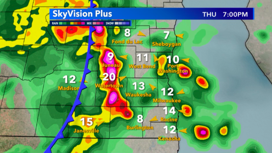
Skyvision Plus future radar late this afternoon/evening for July 9
The Storm Prediction Center has included us in a slight risk for severe weather. While it's only a level two out of five, it's still possible to get damaging winds, hail and even isolated tornadoes.
We'll be keeping that in mind as storms develop -- but once again, the widespread impact is mainly heavy rain. Just because you see some showers earlier in the afternoon doesn't diminish your severe threat, but timing will vary depending on where in southeast Wisconsin you live, with western cities getting impacted first.
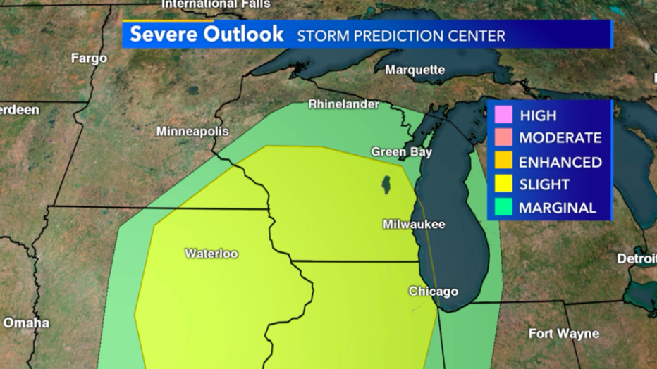
Slight risk for severe weather across southeast Wisconsin for July 9
Breaking down our threats individually, with any strong cold front, damaging straight-line winds are possible. Hail will also be possible, but is mostly only going to impact a few while heavy rain on top of saturated ground could cause flooding. At this time, there is a low threat for tornadoes.
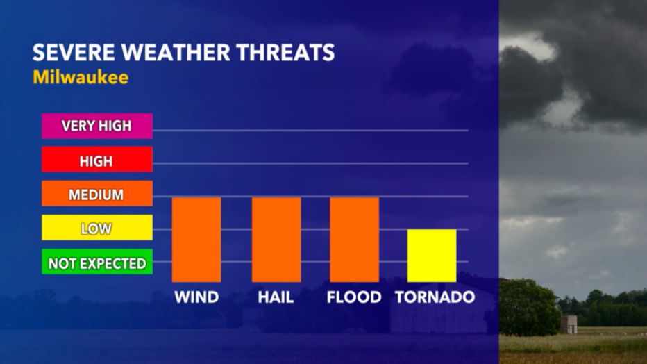
Severe threats for today, July 9