

Snow ending, dense fog settles into southeast Wisconsin
MILWAUKEE - After a messy winter day, dense fog will become an issue in southeast Wisconsin on Tuesday night, Jan. 23.
For that reason, the National Weather Service has issued a dense fog advisory for all of southeast Wisconsin until 10 a.m. Wednesday. Monitor the updated forecast from the FOX6 Weather Experts.
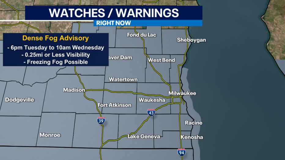
Visibility may drop to a quarter of a mile or even less at times. It may also freeze in spots where pavement temperatures are below freezing, creating icy patches and hazardous travel. Temperatures away from the lake tonight will hover around freezing, so there is better chance for freezing fog inland rather than lakeside.

Another storm system also arrives Wednesday morning. There may be a brief period of freezing drizzle inland, then light rain showers from 9am to 3pm Wednesday. After the rain ends, fog will likely redevelop. We'll rinse and repeat Thursday with steadier afternoon rain showers and times and then more fog.
All the extra moisture from rain and melting snow, plus mild temperatures and light winds, will keep fog around much of the week.
FOX6 Weather Extras
Meanwhile, FOX6Now.com offers a variety of extremely useful weather tools to help you navigate the stormy season. They include the following:
FOX6 Storm Center app

FOX6 News app
FOX Weather app
FOX Weather
Maps and radar
We have a host of maps and radars on the FOX6 Weather page that are updating regularly — to provide you the most accurate assessment of the weather. From a county-by-county view to the Midwest regional radar and a national view — it’s all there.
School and business closings
When the weather gets a little dicey, schools and businesses may shut down. Monitor the latest list of closings, cancellations, and delays reported in southeast Wisconsin.

FOX6 Weather Experts in social media
- CLICK HERE to "Like" the FOX6 Weather Team on Facebook
- CLICK HERE to "Like" Rob Haswell on Facebook
- CLICK HERE to "Like" Tom Wachs on Facebook
- CLICK HERE to "Like" Stephanie Barichello on Facebook
- CLICK HERE to "Like" Eric Manges on Facebook
- CLICK HERE to "Like" Lisa Michaels on Facebook
- CLICK HERE to "Follow" the FOX6 Weather Team on Twitter
- CLICK HERE to "Follow" Rob Haswell on Twitter
- CLICK HERE to "Follow" Tom Wachs on Twitter
- CLICK HERE to "Follow" Stephanie Barichello on Twitter
- CLICK HERE to "Follow" Eric Manges on Twitter
- CLICK HERE to "Follow" Lisa Michaels on Twitter