

Southeast Wisconsin storms, snow, potential record heat, frigid temps
MILWAUKEE - Southeast Wisconsin is going to get a dose of all types of weather this week -- from record warmth to strong storms, snow and frigid temperatures. Tuesday's setup for potential severe weather is going to impact many areas in the Midwest and into the Ohio River Valley.
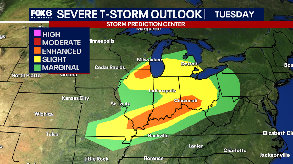
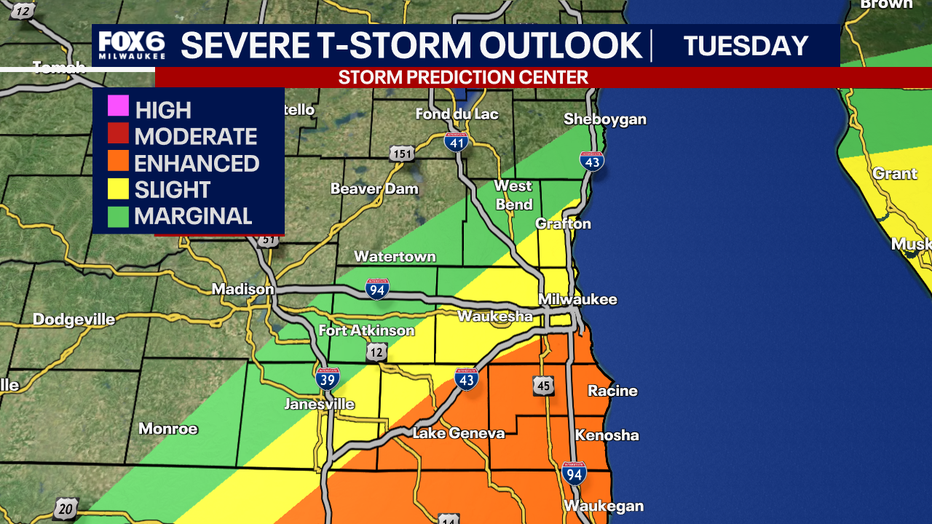
Tuesday late afternoon and evening is when you will want to be weather aware as areas have been upgraded to an enhanced risk for all of Kenosha and Racine counties, portions of Rock, Walworth, Waukesha and Milwaukee counties. A slight and marginal risk is still issued for additional areas.
Storms could start firing up as early as 5 p.m. and could continue through 11 p.m. tonight. Although the peak hours to be weather aware are from 7 p.m. to 9 p.m. The biggest impacts from storms will be large hail, damaging winds, and an isolated tornado.
SIGN UP TODAY: Get daily headlines, breaking news emails from FOX6 News
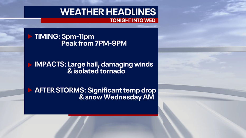
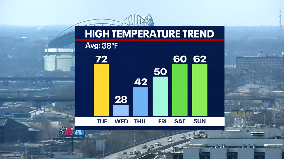
Below is a timeline of potential development on Tuesday, but notice after the storms exit between 10 p.m. and 11 p.m., blustery winds pick up out of the northwest. This will usher in cold air and change precipitation over to snow. Some areas could receive a quick half an inch to one inch of snow come Wednesday morning. Temperatures will drop 40+F which may shock your system on Wednesday.
Thankfully, the cold temperatures will be short-lived as more above average temperatures are back in the forecast at the end of the week and into this upcoming weekend.
FREE DOWNLOAD: Get breaking news alerts in the FOX6 News app for iOS or Android
Stay tuned with your FOX6 weather experts as they will be tracking the storms and snow closely.