

Wisconsin winter in December; warmer temperatures linger
MILWAUKEE - If you're a fan of warm temperatures, there is a holiday treat in the forecast just for you! As of Dec. 12, most of this month has been very warm with a total of nine days above average. While the past few have been below average, more warm days are in the forecast ahead.
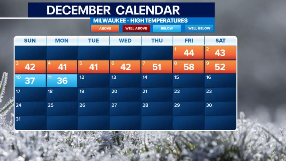
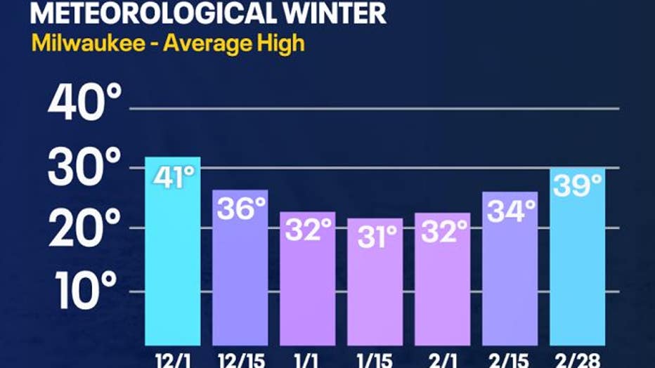
Keep in mind that the average high temperatures fluctuate through December. At the beginning of the month, we should see high temps in the low 40s and in the low 30s by the end of the month.
Despite what temperatures should be, oceanic and atmospheric conditions play a role in whether we will experience warmer or cooler conditions. This is why the FOX6 weather team had a special weather series on El Niño back in November 2023. You can view these stories on FOX LOCAL (or linked below). El Niño is ongoing this winter, which will impact weather across the United States.
SIGN UP TODAY: Get daily headlines, breaking news emails from FOX6 News
Severe Weather Awareness Week
- Wisconsin winter forecast: El Niño, what it means for you
- Wisconsin El Niño winters past have proven challenging
- Wisconsin winter; snow squall dangers, cities' snow removal costs
- Wisconsin El Niño winter; allergy season impact
- Wisconsin salt use: hidden costs, environmental impacts
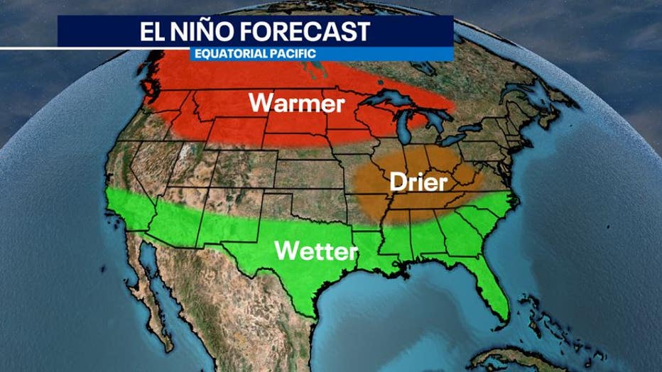
El Niño is forecasted to bring warmer than average temperatures in northern states-including Wisconsin. Since August 2023, we have started entering into a strong El Niño oscillation pattern. This is going to bring warmer temperatures in the upcoming months, but that doesn't mean that the colder days will be non-existent. We could still have periods of cold temperatures and even snow, but overall, there will be less this season.
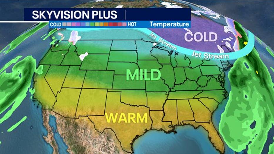
The current setup for December 19th through December 22nd looks very calm across the United States. There will be two areas of energy on the coasts that will be cut off from the jet stream to the north.
FREE DOWNLOAD: Get breaking news alerts in the FOX6 News app for iOS or Android
This will bring precipitation in the Pacific and Atlantic Oceans and near the coastlines. Further inland, zonal air flow will be present, which means wind will blow from west to east. This creates more stable temperatures across latitudes. The jet stream acts as a ribbon moving up and down. With it pushing north into Canada and zonal winds in place, this means little to no spin in the atmosphere, leading to a period of calmer weather.
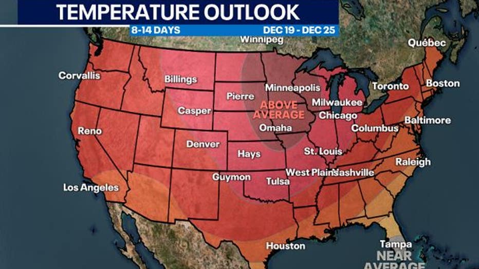
Temperatures in the long range forecast are anticipated to be above average through the end of the month. Meteorologists use various ways to long range forecast. One of them is using what we call analogs. This method examines today's forecast and also looks back to the past when similar weather scenarios occurred.
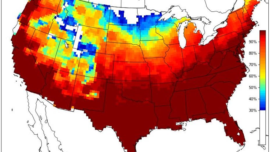
Based on the top analogs that matched, we have a 70 to 80% chance of having temperatures in the 40s for Dec. 19 through Christmas. This puts temperatures anywhere from 5 to 15 degrees warmer than average at times.
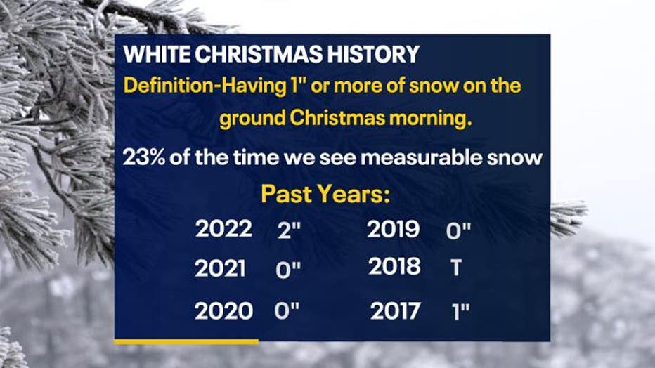
Last year, in 2022, we didn't receive any snow, but we did have 2" on the ground already marking it as a White Christmas. With warmer temperatures expected this year, we would lean towards a green Christmas rather than a white one. For southeast Wisconsin, 50% of the time we see any snow on Christmas, including a trace, while 23% of the time we have measurable snow of at least 0.1" or more.

Snow and rain looks to be bleak this month. We will watch for a system that could move in near Christmas. Stay tuned with your FOX6 Weather Experts for more information.