

Areas in North Carolina set to get 6+ inches of snow only a week after being 80°F
SOUTHEAST WISCONSIN -- Since Dec. 1, 2019 Milwaukee has seen 10" less snow than average and a big reason is we haven't had a single storm drop more than 6" at one time. While southeast Wisconsin has lacked major snow events this season a large portion of North Carolina is about to get hammered with some areas getting over 7" by Friday night, Feb. 21.
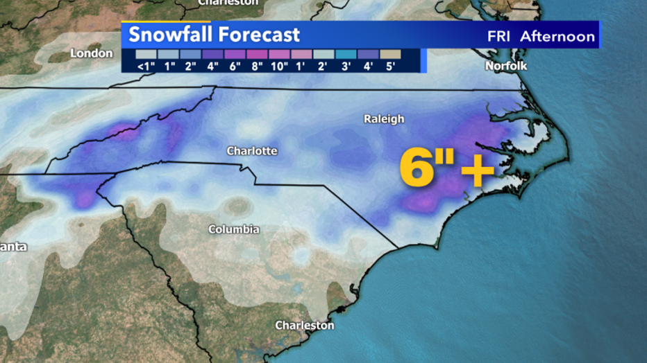
Snowfall Forecast for the Carolinas through Friday afternoon, Feb. 21
It's important to note much of the state of North Carolina is seeing it's earliest Spring ever. Many new branches and twigs will have to support wet and heavy snow that will likely lead to widespread breakage. Broken branches and snow-covered roads will likely lead to major travel issues in North Carolina. Those same areas were nearly 80°F in mid-February.
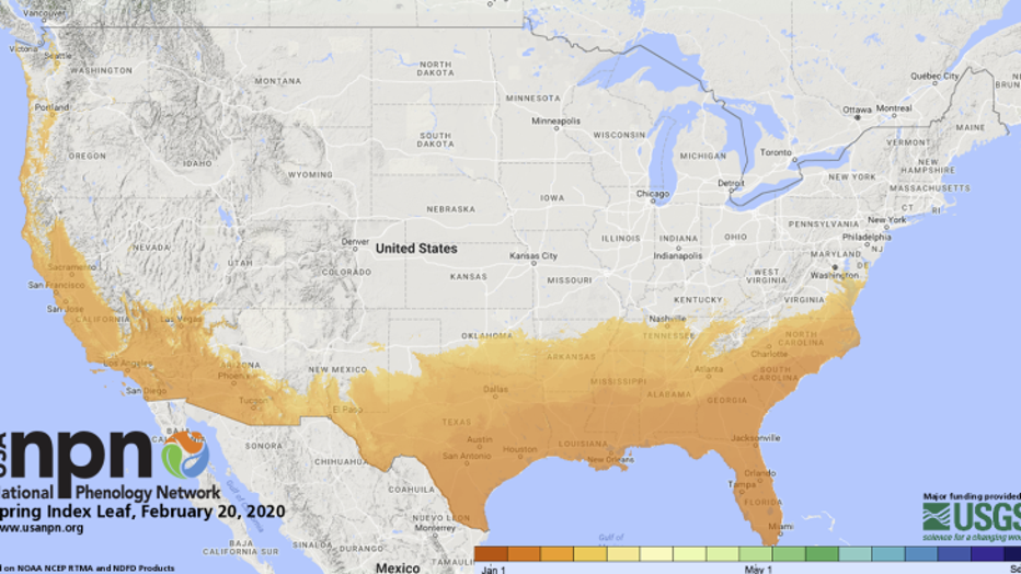
NPN Spring Index shows areas that have already seen budding trees and when.
This same system has caused widespread flooding in the south. Mostly rain with start Thursday, Feb. 20 but stay as snow especially Thursday night, Feb. 20 into early Friday morning, Feb. 21.
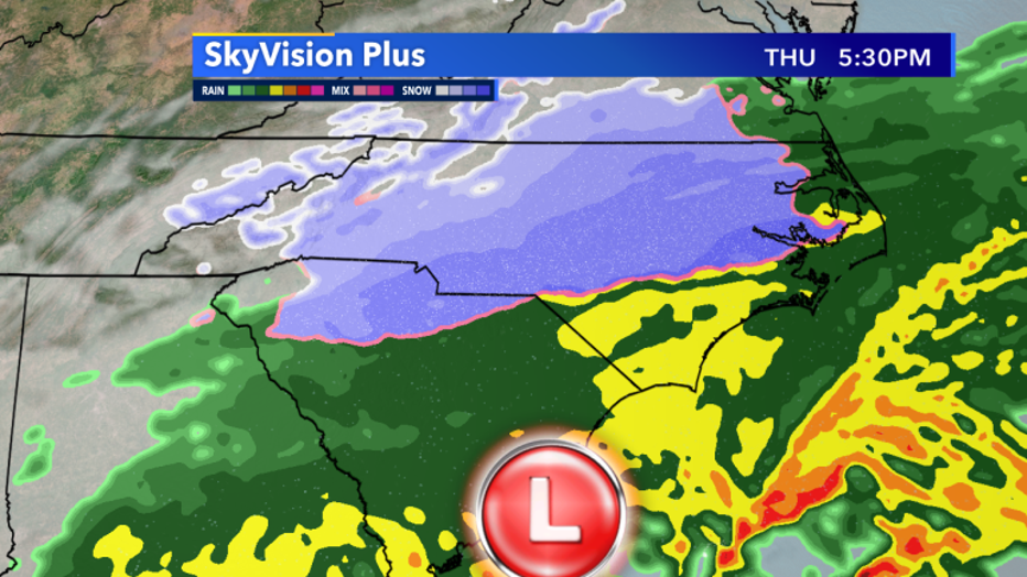
Skyvision Plus precip potential this evening, Feb. 20