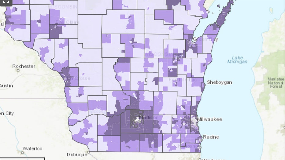
Geographic breakdown of COVID vaccination data in Wisconsin
MADISON, Wis. - The Wisconsin Department of Health Services (DHS) released on Friday, July 9 maps and corresponding downloadable data tables that break down COVID-19 vaccinations by new geographic boundaries.
A news release from DHS says the new maps allow Wisconsinites to view existing COVID-19 vaccination data by municipalities (cities, towns, and villages), zip code tabulation areas, school district boundaries, and census tracts.

DHS also recently released an additional filter option for the COVID-19 Vaccines for Wisconsin Residents dashboard. Users can now select to view vaccination data for just the adult population ages 18 and older.
The new geographic boundaries use location data from the Wisconsin Immunization Registry (WIR) to populate the maps with COVID-19 vaccination information, based on the address a person has on file in WIR. No personally identifiable information is shared.
FREE DOWNLOAD: Get breaking news alerts in the FOX6 News app for iOS or Android.
Data represent all COVID-19 vaccinations entered into WIR for those who reside in that geographic area. Darker colors indicate a higher rate of vaccination. Clicking within a specific boundary provides location-specific metrics. These data are available for download via links in the call-out box at the bottom of each data page.
Featured
The Hop skips Fiserv Forum, Bucks in Finals: 'Missed opportunity'
Thousands of Bucks fans will flood downtown Milwaukee on Thursday night, July 8 for Game 2 of the NBA Finals. But will they ride the Hop?
Featured
Retail theft in Menomonee Falls, $100+ worth of merchandise stolen
The Menomonee Falls Police Department is investigating a retail theft that occurred June 19 at the Target on Shady Lane.

Bucks Foundation benefits from Deer District watch parties
On or off the court, philanthropy plays a large role in the culture created by the Milwaukee Bucks.


