

3 southeast Wisconsin tornadoes confirmed; NWS surveys damage
Assessing Wisconsin severe weather, tornado damage
Personnel from the National Weather Service spent Monday, May 27 in Milton, Wis. in Rock County to survey severe weather damage from the night before.
MILTON, Wis. - Personnel from the National Weather Service (NWS) spent Monday, May 27 in Milton, Wis. in Rock County to survey severe weather damage from the night before.
The NWS confirmed an EF-0 tornado with peak wind speeds of 80 mph touched down around 5 p.m. Sunday, May 26, near Footville, Wis. It was on the ground for about 22 minutes, going up to Milton.
The damage included large trees that were uprooted and large branches that snapped.
"So far, it’s a lot of tree damage, which typically tells us its one of the lower ends of our tornado rankings. We look at the whole path before we call a tornado a certain level. So far, a lot of tree damage that we’re seeing," said Tim Halbach of the National Weather Service. "We go point by point, look at every structure that has been hit. Give it an assessment of damage."
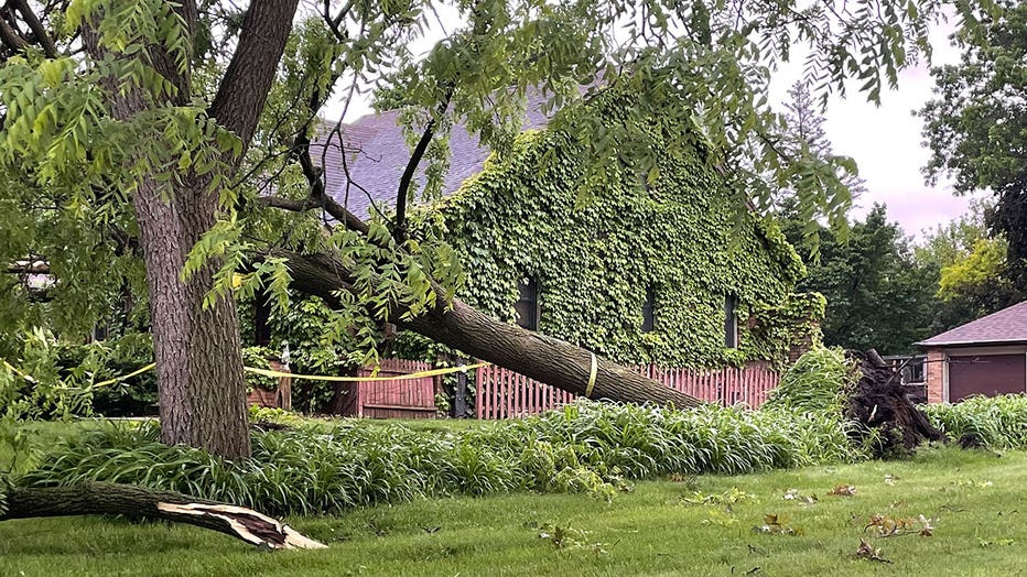
Storm damage in Milton
Storms ripped through the Milton area on Sunday. NWS investigators planned to visit this city to determine if there was a tornado and how powerful it was on the Enhanced Fujita Scale. The Fujita Scale is used to assign a tornado a 'rating' based on estimated wind speeds and related damage, the NWS says.
SIGN UP TODAY: Get daily headlines, breaking news emails from FOX6 News
"We try to get out as soon as we can so we can see where the debris went to piece together what happened," Halbach said.
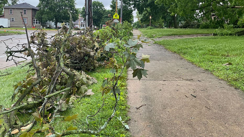
Storm damage in Milton
Tornado warning sirens were heard in Milton and several nearby counties. Property owners are trying to make sense of exactly what happened Sunday.
"During the tornado, I was in my basement hiding," said resident Kellan Zinzow. "I’m thankful nothing really got damaged except for a few pots."
FREE DOWNLOAD: Get breaking news alerts in the FOX6 News app for iOS or Android
"We were just minding our own business cleaning up playing some music and then we heard the sirens go off," said David Schroeder, Milton homeowner. "Then just a few minutes later and we saw the wind get pretty strong and the branches started blowing by the window."
It appeared the twister hit Rachel Garcia's street hard.
"I’m safe, my daughter is safe, everyone around here is safe," she said. "It went all the way over my house, hit the top of my house, hit the tree, hit my neighbor’s tree, went across the street. It’s going to be a lot of mess, a lot of cleanup, but it will be done."
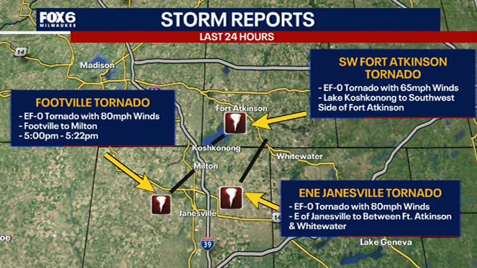
A second EF-0 tornado was confirmed by the NWS over Lake Koshkonong in Jefferson County. The NWS said it reached wind speeds of 65 mph at around 5:27 p.m. Sunday.
The second tornado headed toward Fort Atkinson. Damage was mainly confined to downed tree limbs.


Southeast Wisconsin tornado warnings, severe weather
Tornado warnings were issued for counties across southeast Wisconsin on Sunday, May 26.
Another EF-0 tornado was confirmed to have touched down at 5:15 p.m. Sunday, with an estimated peak wind speed of 80 mph, developed east of Janesville and tracked to the north-northeast into Jefferson County, ending in the vicinity of US Highway 12 between Fort Atkinson and Whitewater.