Southeast Wisconsin's 1st accumulating snow of the season Tuesday
Weather Webcast with Meteorologist Stephanie Barichello
Quiet today then snow and wintry mix expected Tuesday through midday Wednesday. A few inches of slush possible, although potentially less lakeside.
MILWAUKEE - The first accumulating snow of the season is expected on Tuesday, Nov. 15. Snow will start Tuesday morning, really picking up by late morning and midday. Snow continues all day before gradually tapering off Wednesday. More rain than snow is possible near the lake Tuesday afternoon/evening. Meanwhile, heavier bands of snow are possible just inland. This will be a longer duration event meaning snow totals are for Tuesday & Wednesday.

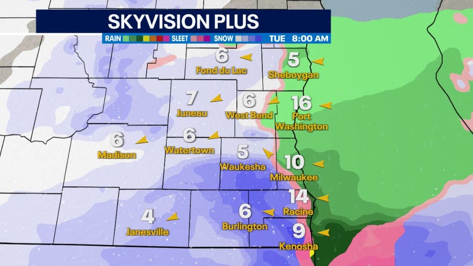
Skyvision Plus Snow Forecast for 8 a.m. Tuesday
Inland areas can expect 2-4" of heavy, wet snow through Wednesday. This will cause slick/slushy roads and low visibility at times. Plan for extra time to get to work on Tuesday & possibly Wednesday, and stay up to date with the latest forecast.

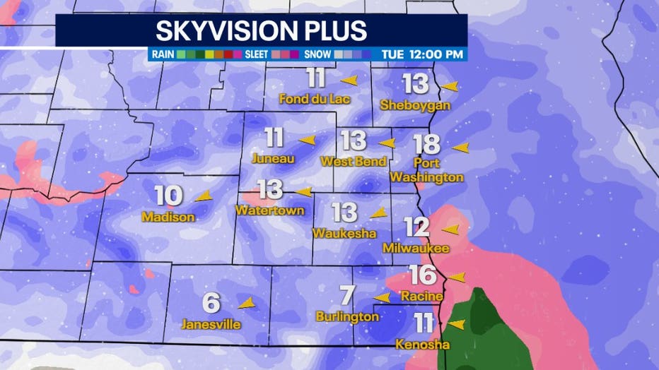
Skyvision Plus Snow Forecast for 12 p.m. Tuesday
The heaviest snow will occur during the day on Tuesday. The snow will start after 6-8am with peak intensity around noon. Snow will gradually taper off on Wednesday.
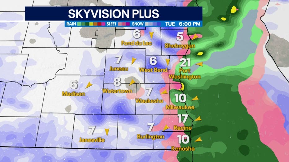
Lake Michigan will play a role in this snow. We could see "lake enhancement," meaning that heavier bands of snow are possible in areas just inland as lake moisture is drawn into the storm system, which could bring isolated higher totals. There will also be periods of rain or wintry mix along the lake, as the lake water is still relatively warm, which would lead to much lower snowfall totals.

Skyvision Plus Snow Forecast for 6 p.m. Tuesday
SIGN UP TODAY: Get daily headlines, breaking news emails from FOX6 News
While this storm won't produce huge snow totals, it will be an impactful day on Tuesday with slick roads and low visibility at times.

