

Southeast Wisconsin April 2023; 10th warmest in record books
April has come and gone in the blink of an eye, and we had vast weather changes during this transition month into spring.
The first week of April was mild with days that were 10F to 20F above average, but this was just the beginning of the warm temperatures. The second week of April had everyday warmer than average with temperatures even warmer by 20F to 30F!
The second half of the month was the complete opposite where more days were below average, 5F to 10F, and in the 40s.
There were a total of 19 days above average (63%) and 11 days below average (37%). Due to the warm first half of the month, this helped raise the average temperature. Overall, April had an average temperature of 49.4F which is +3.1F warmer than normal. April 2023 is ranked the 10th warmest April in the record books.
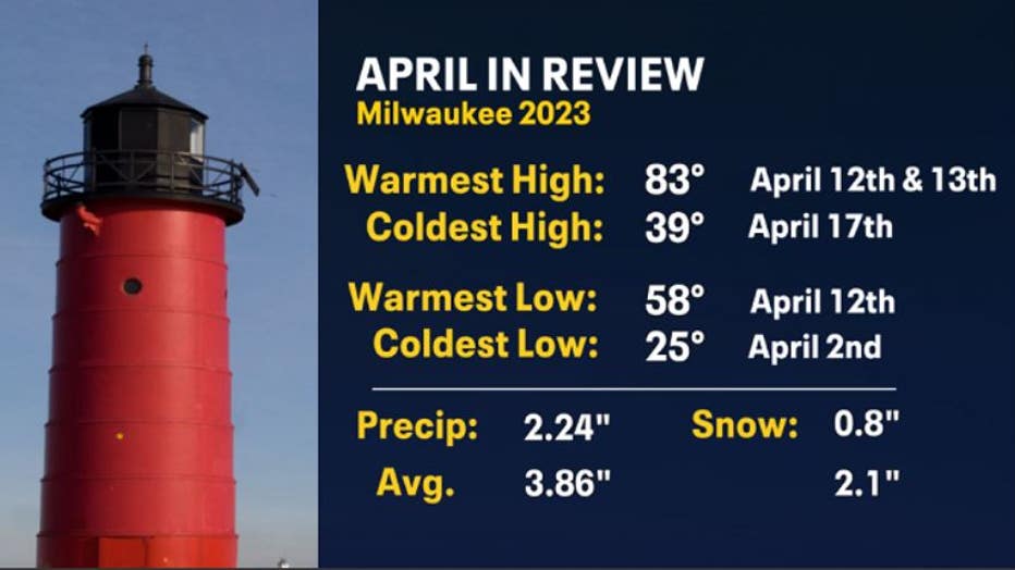
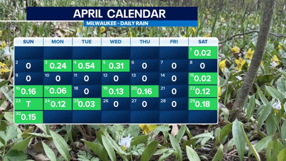
In terms of precipitation, April was relatively dry. Milwaukee received 2.24" which was a -1.62" deficit. We didn't make up for it in snowfall either as there was a deficit of -1.3". Days that we had our highest rainfall totals were spread out in the beginning, middle, and end of the month. This is when the largest temperature swings happened with the passing of low-pressure systems.
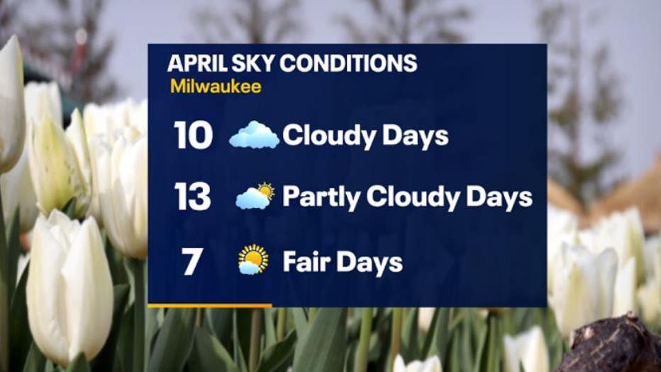
Majority of the days in April had some sort of cloud cover with 10 days recorded at cloudy, 13 days recorded at partly cloudy, and 7 fair days with more sunshine.
One of the bigger weather events that occurred in the middle of the month on April 19. Elevated storms rolled through southeast Wisconsin brining continuous heavy rain over Dodge, Washington, and Ozaukee counties causing flooding on roads and in low-lying areas.
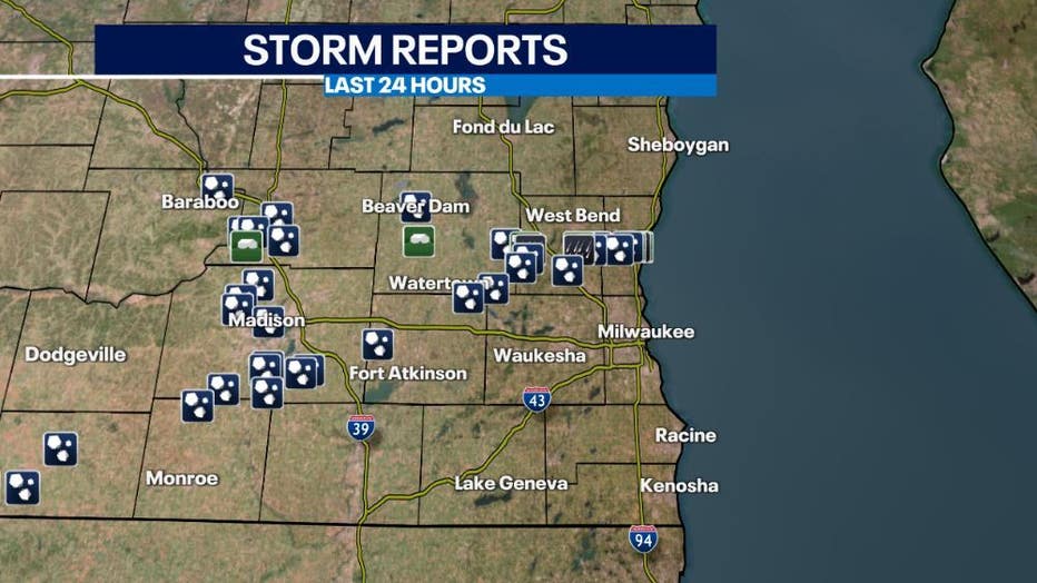
In addition to heavy rain, these storms brought lots of various sized hail. Strong to severe storms were capable of producing large enough hail, 1" or larger in diameter, to be considered severe.
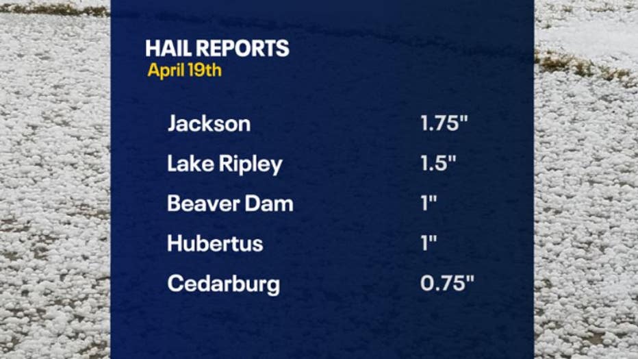
To put this into perspective: 1" hail the size of a quarter, 1.5" hail is the size of a ping pong ball, 1.75" hail is the size of a golf ball.

(Photo Credit: Brandon in Jackson)
Even areas that didn't see necessarily large hail, small hail came down in what seemed like bucket loads coating the ground as if it just snowed. In some areas, the snow plows even came out to clear it.
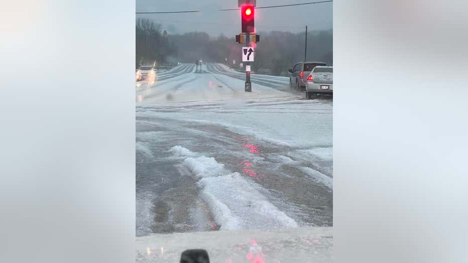
(Photo Credit: Ashley in Pikes Lake/Hartford Area)
The start of May is cold with a combination of rain/snow. The outlook for this month is forecasted to be drier than average with equal chances of temperatures warmer and/or cooler than average. If we do stay more on the dry side, you may need to do extra watering for planting season.