Chance of snow for the Upper Peninsula, northern Wisconsin
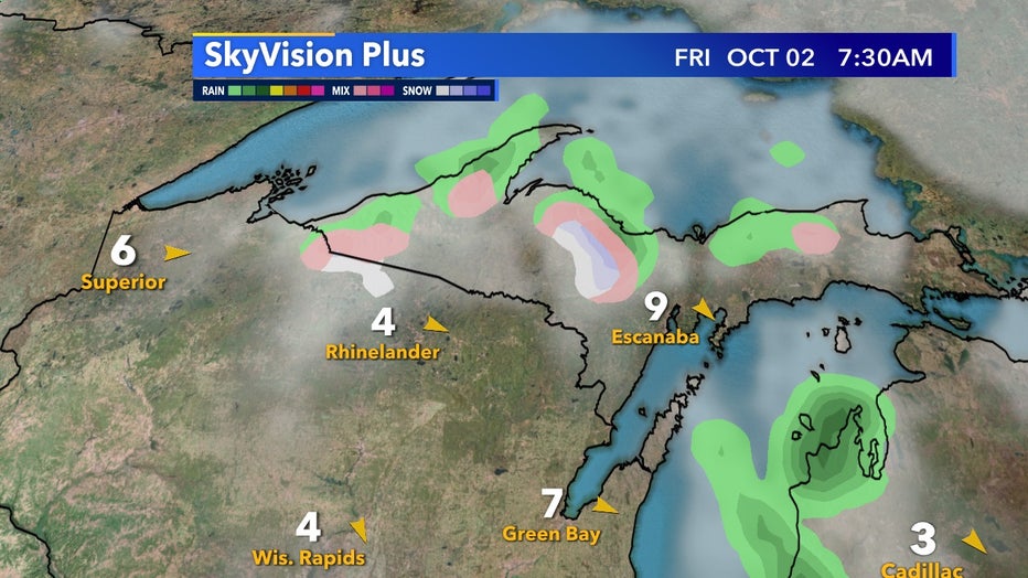
All of southeast Wisconsin has frost potential both Friday, Oct. 2, and Saturday, Oct. 3 mornings. But the Upper Peninsula has a chance for snow!

SkyVision Plus for Friday, Oct. 2 7:30am
Most areas will only see small accumulations. But on grassy locations, it is possible to see more than an inch. Typically northern Wisconsin and parts of the U.P. do not see snowfall until mid-October. But winter is coming a little early this year for our neighbors up north.
SkyVision Plus has most of the snow potential coming Friday morning, Oct. 2 between 3:30 a.m. - 9 a.m. as the overnight temperatures dip below freezing. By midday, precipitation will switch over to rain but could make for some beautiful photos mixed in with the already peaking foliage.
While southeast Wisconsin will get cold temperatures during this time, long-term temperatures rebound to more seasonable conditions.
FREE DOWNLOAD: Get breaking news alerts in the FOX6 News app for iOS or Android.
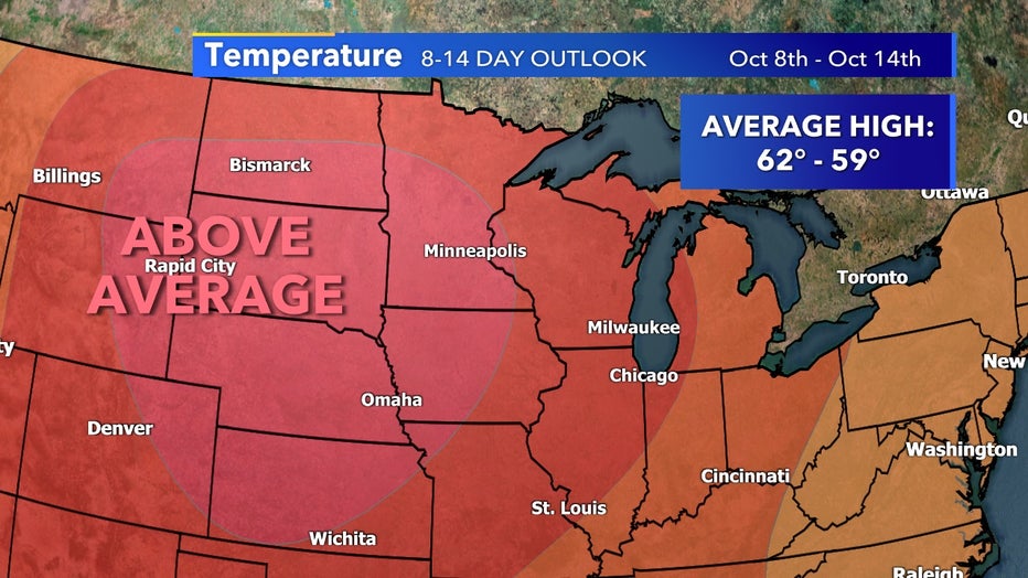
Longer-term temperature outlooks keep us above average as we enter mid-October which should keep any snow potential at bay at least for the first half of the month.

8-14 Temperature Outlook between October 8th-14th
CLICK HERE for the complete FOX6 Weather Forecast.
Related
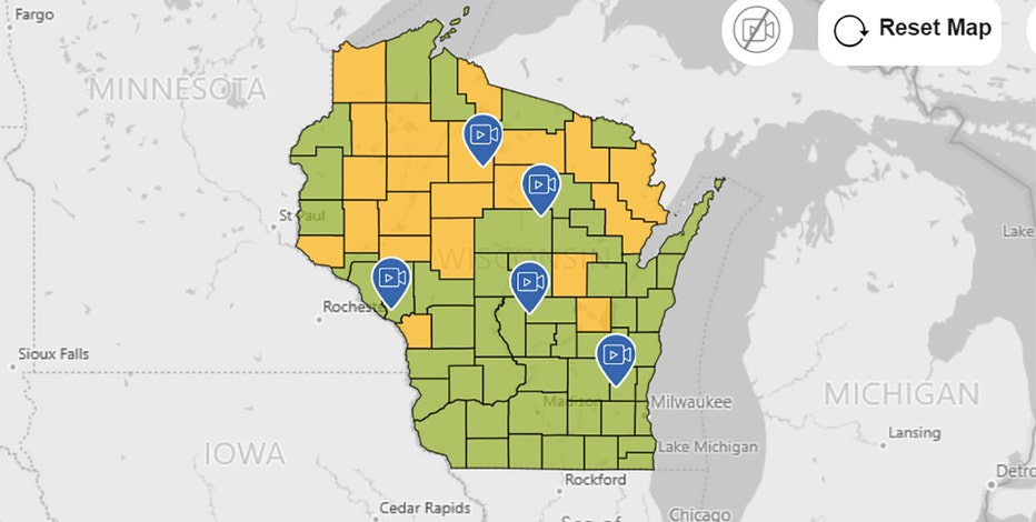
Just released: Travel Wisconsin's 2020 Fall Color Report 🍂
If you are looking to make the most of a weekend drive, visit Travel Wisconsin's Fall Color Report before you hit the road.


