Gusty winds continue to hammer southeast Wisconsin
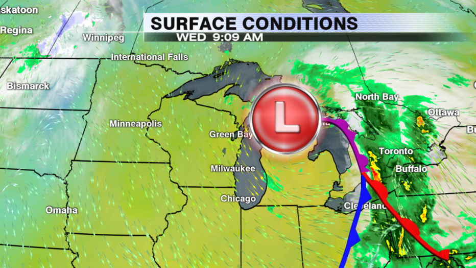
SOUTHEAST WISCONSIN -- Gusty winds continue to be the top weather story across Wisconsin Wednesday, Oct. 16. Due to a low currently centered over Northern Michigan, there is a tight gradient of pressure right over the eastern portion of the state. The motion of air from high to low pressure is what gives us wind and today we have a lot of it!

Low over northern Michigan continues to move East and it won't be until tonight that wind speeds calm down
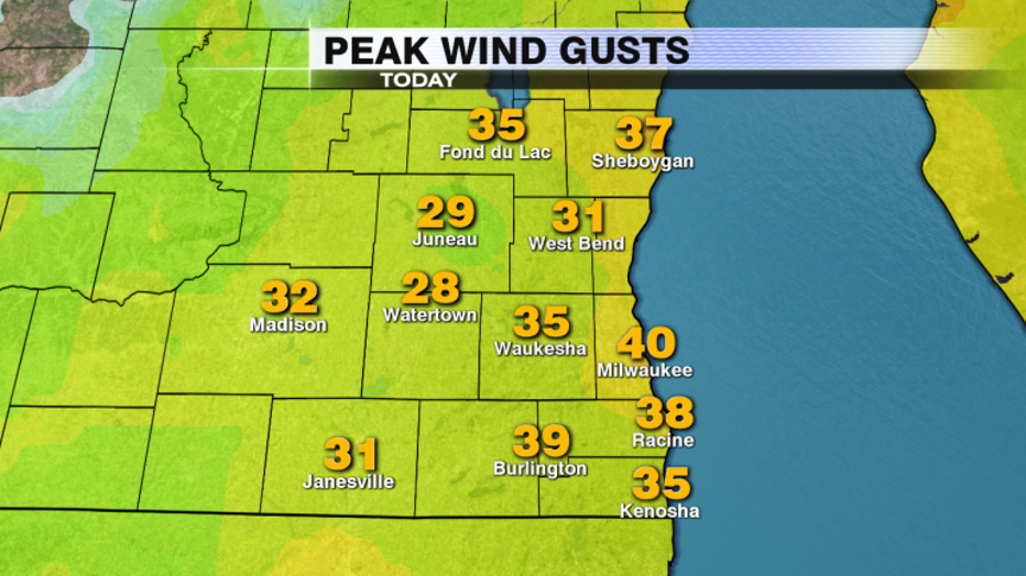
So far peak wind gusts have been measured over 35mph for many cities in southeast Wisconsin and throughout the day don't be surprised if we hit 40 at many locations. As of Wednesday morning, Milwaukee has seen the strongest gust at 40 mph with Burlington and Racine close behind.

Peak wind gusts since midnight. Areas closest to the water have seen the strongest winds.
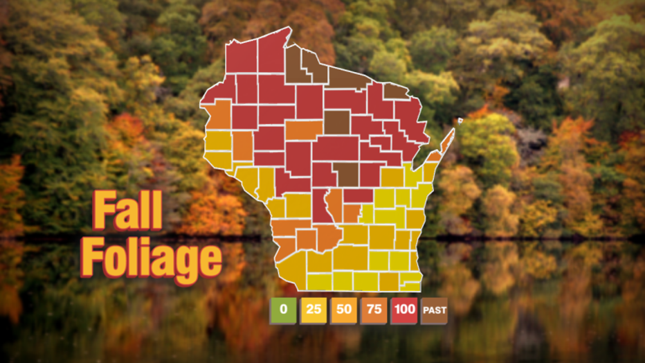
If you've yet to chase Fall foliage in the state one concern with these winds is its the impact on leaf cover. Some northern counties have already past their peak color, it's likely these gusts would thin many trees up North. The good news is a majority of southeast Wisconsin is just starting to turn and the leaves haven't been able to breakdown yet.

Fall foliage levels across the state of Wisconsin as of 10-15-19
For the most up to date map on current fall foliage head to travelwisconsin.com and make sure to download our FOX6 Storm Center App for the latest forecast and 6-Day Planner for your area.

