It's been 23 years since one of the worst ice storms in US history
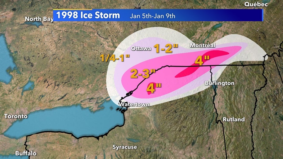
Jan. 5, 1998, would mark the beginning of what would become one of the largest ice storms in United States history. Isolated spots in upstate New York and Ontario nearly received 4" of freezing rain which accumulated into heavy ice sheets causing over $3 billion dollars worth of damage.

Exact mapping has been smoothed over to fit for this image
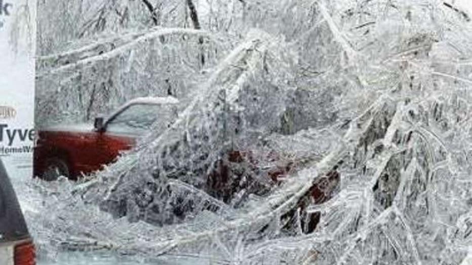
To get a true idea of how heavy these ice sheets were the picture below was an image of the aftermath. Millions of acres of trees crumbled under the weight of the ice, destroying powerlines that left people in the dark for weeks.
Sadly 40 people died as a result of the storm's impacts and many changes to vegetation are still visible to this day in the area.

Millions of acres of forest collapsed due to the weight of the ice which intern trapped the entire region
There are many factors that came together to create this ice storm, but the main being elevated middle-level warm air and frigid surface air. The precipitation would have started as snow in the upper atmosphere but once interacting with warm middle-level air it would have melted to rain.
Now rain as the precipitation reaches the surface air it was met with well below freezing conditions and would have become supercooled but without enough time to form snow. Instead, it created freezing rain which turns to ice on contact with cold objects.
This atmospheric profile lasted for five days and multiple rounds of precipitation allowed for this historic ice storm to happen. Altogether during this time over 5" of rain fell in parts of New York which also caused widespread flooding.

