

Wisconsin snowstorm on Jan. 12-13, 2024; recapping what happened
MILWAUKEE - A powerful winter storm hit the upper Midwest on Friday, Jan. 12, 2024. This storm brought blizzard-like conditions and over 12" of snow to some areas. Over 100,000 customers lost power and were without power for days. Bitter cold set in less than 48 hours after the heavy snow fell. This system was the third round of snow of the week and the second round of Winter Storm Warnings issued that week.
We had our first winter storm on Tuesday, Jan. 9, 2024. This was the first winter storm after we tied a record low snow amount (Trace) in December and shattered our average temperature record in December. It was the warmest and tied for the least snowy December 2023 because of El Niño. Lake Michigan water temperatures were running 2-3°F above average (around 40 degrees). The first winter storm hit Tuesday of that week in January and the forecast was overdone in spots because of the warm lake air overspreading southeastern Wisconsin. Milwaukee Mitchell International Airport only had 1.7" of heavy/wet snow combined with all rain and a mix at times out of that Tuesday system (less along the lakeshore), with inland counties around 7". Winter Storm Warnings were in effect on Tuesday, MPS and most schools closed. It was a long-duration event but changed to all rain in the Milwaukee area for a time, so the overall impact wasn't as large as the next system would prove to be.
Wednesday night/Thursday morning of that week we had a quick storm system with 3.7" of fluffier snow (20:1 snow ratio). The Wednesday snow was the biggest snow of the season to date in Milwaukee, surpassing the 3.3" we had on Halloween 2023.
SIGN UP TODAY: Get daily headlines, breaking news emails from FOX6 News
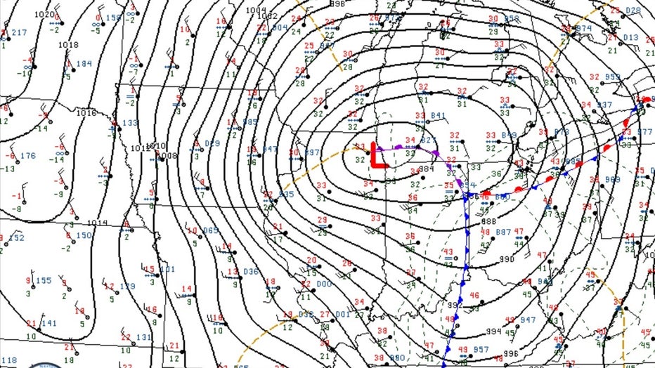
6pm 1/12/24 Surface Map. Credit: College of DuPage
Another strong low pressure system (similar to Tuesday's track) was set to move across the upper Midwest on Friday, Jan.12, 2024. Lake Michigan water temperatures had cooled slightly, and this system featured slightly cooler air with it, but questions remained about how much lake influence would set up with this system. Winter Storm Warnings were issued once again for Friday for the region. What differed with this system was the strong warm air aloft that produced snow after 4 a.m.-5 a.m. Friday. This brought heavy/wet snow to the entire region, with the heaviest snow falling by midday (6-8" in spots). Schools closed across the area for the second time in a week. The snow did not let up. It continued all day and into the overnight hours (becoming a little fluffier overnight). Along the immediate lakeshore, however, it stayed all rain/mix within a few hundred feet of the lake. North Bay reported 1.7" of total snow from this system. Milwaukee reported 7.7". Totals eclipsed a foot inland, with estimates as high as 18" of heavy/wet snow in West Bend. The wind was also a huge issue. The National Weather Service upgraded Fond du Lac and Sheboygan counties to a Blizzard Warning from 5 p.m.-3 a.m. during this event with wind gusts over 40mph. Over 100,000 people lost power in SE WI. Surface temperatures were still mild, with temperatures in the 20s and 30s. Arctic air (single digits) blew in by Saturday night, Jan. 13, 2024.

This was one of the most difficult storms to forecast given the lake influence and prior storm system the Tuesday before. The low tracked just to our south, with air pressure as low as 29.01" at Milwaukee Airport with the surface low around 981mb. (air pressure was also very low with the Tuesday system). Chicago went from snow to all rain by late morning into the early afternoon. So the track was also critical in that it kept us from changing over to all rain (which was a concern in earlier forecasts of this system).
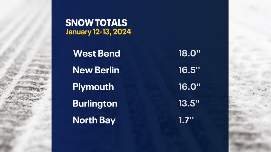
Snow total ranges were wild out of this system. 1.7" in North Bay (Racine Co)., 4.6" near Racine, 7.7" at Milwaukee (6-7:1 snow ratio), 16.5" New Berlin, 16" Pewaukee, Hubertus, 16". 16" Plymouth, 14" West Allis, 11" Greendale, 14.4" Sullivan (11.2:1 ratio). Burlington 13.5", Ozaukee Co: 10-12", Oconomowoc 10", Ft. Atkinson 11.5", Delafield 14.5", Elkhorn, 13", Palmyra 8.5", West Bend 18", Caledonia 3", Menomonee Falls 14.5", Campbellsport 14", Fond du Lac 12", Mayville 6", Wind Lake 11" (see complete list below).
FREE DOWNLOAD: Get breaking news alerts in the FOX6 News app for iOS or Android.

While most areas just a few miles from the lake were in the 12"-16" range, it is possible that the 18" amount in West Bend and some associated higher totals in the area could have experienced upslope/orographic lift from the Kettle Moraine. Winds were out of the E to NE all day, eventually the NW by evening. While the large scale features of this system were robust, delivering heavy snow everywhere just inland, the snow totals show the heaviest totals along the Kettle Moraine. This would line up with localized orographic lift/upslope flow playing a role in slightly higher snow totals in these areas. The ENE wind hit the higher elevations of the Kettle Moraine (take Holy Hill, for example), causing the air to rise and creating localized heavier bands of snow. In addition, lake enhanced snow also likely played a role. This is where the NE wind off of unfrozen waters of Lake Michigan picked up the lake moisture, causing heavier pockets of snow on land. The Jan. 12, 2024, snow event will not only go down as one of the widest snow ranges we've seen in a while, but also one of the most interesting local meteorological events in quite some time. The warm lake influence, lake enhanced snow and upslope from the Kettle Moraine all played a role in this strong storm.
David Kwasinski from Waterford, WI sent us this video of a power line on fire on Friday, Jan. 12, 2024:

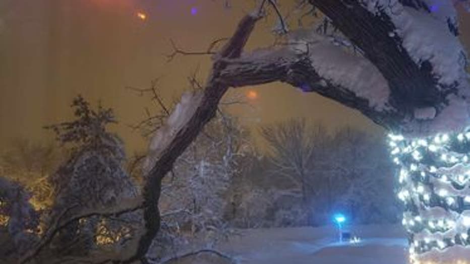
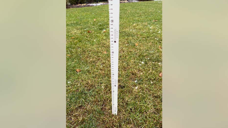
Here are viewer photos from the snowstorm:
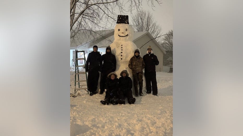
12' Snowman from Brenda and friends in West Bend, WI.
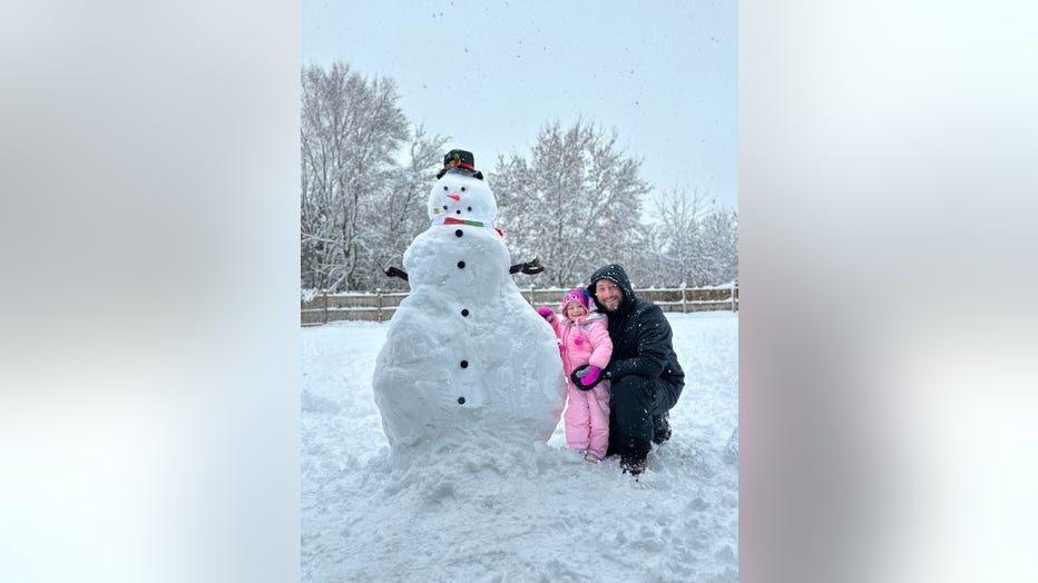
Hannah and Josh in Twin Lakes, WI. This snowman was built by 11:30am!
Tree damage from Joy in Waukesha
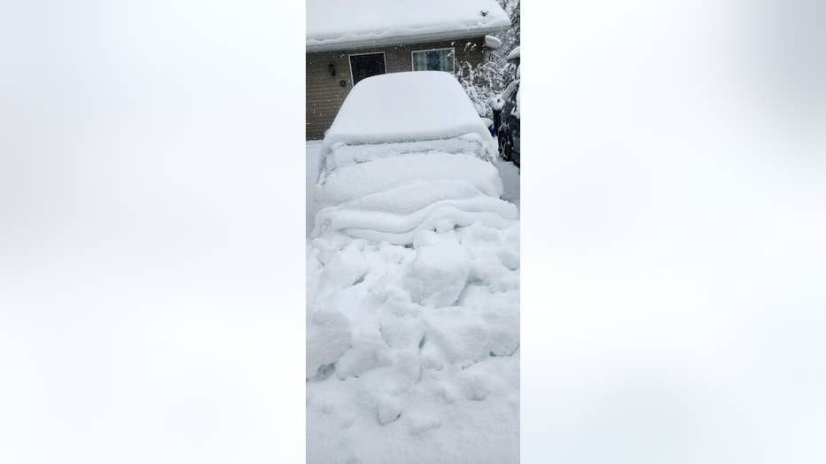
Buried car from Lisa in Kansasville, WI.
Robert in North Bay near the lake was asking "what snow?!"
Snow totals from Friday, Jan. 12, 2024:
18.0 West Bend
16.5 New Berlin
16.3 Germantown
16.0 Hubertus
16.0 Plymouth
16.0 Pewaukee
16.0 Brookfield
15.7 Sussex
14.5 Delafield
14.5 Menomonee Falls
14.4 Sullivan
14.1 Butler
14.0 West Allis
14.0 Campbellsport
14.0 Horicon
13.5 Burlington
13.1 Port Washington
13.0 Elkhorn
12.5 Waukesha
12.0 Mequon
12.0 Saukville
12.0 Ixonia
12.0 Fond du Lac
12.0 Ripon
12.0 Salem Lakes
11.5 Fort Atkinson
11.5 Jackson
11.0 Pell Lake
11.0 Wind Lake
11.0 Greendale
10.5 Oconomowoc
10.4 Beaver Dam
8.7 Lake Mills
8.5 Palmyra
7.7 Airport
6.0 Mayville
4.6 Racine
3.8 Sturtevant
3.0 Caledonia
1.7 North Bay
FOX6 Weather Extras
Meanwhile, FOX6Now.com offers a variety of extremely useful weather tools to help you navigate the stormy season. They include the following:
FOX6 Storm Center app

FOX6 News app
FOX Weather app
FOX Weather
Maps and radar
We have a host of maps and radars on the FOX6 Weather page that are updating regularly — to provide you the most accurate assessment of the weather. From a county-by-county view to the Midwest regional radar and a national view — it’s all there.
School and business closings
When the weather gets a little dicey, schools and businesses may shut down. Monitor the latest list of closings, cancellations, and delays reported in southeast Wisconsin.

FOX6 Weather Experts in social media
- CLICK HERE to "Like" the FOX6 Weather Team on Facebook
- CLICK HERE to "Like" Rob Haswell on Facebook
- CLICK HERE to "Like" Tom Wachs on Facebook
- CLICK HERE to "Like" Stephanie Barichello on Facebook
- CLICK HERE to "Like" Eric Manges on Facebook
- CLICK HERE to "Like" Lisa Michaels on Facebook
- CLICK HERE to "Follow" the FOX6 Weather Team on Twitter
- CLICK HERE to "Follow" Rob Haswell on Twitter
- CLICK HERE to "Follow" Tom Wachs on Twitter
- CLICK HERE to "Follow" Stephanie Barichello on Twitter
- CLICK HERE to "Follow" Eric Manges on Twitter
- CLICK HERE to "Follow" Lisa Michaels on Twitter