

SE Wisconsin severe weather Tuesday morning; damaging winds
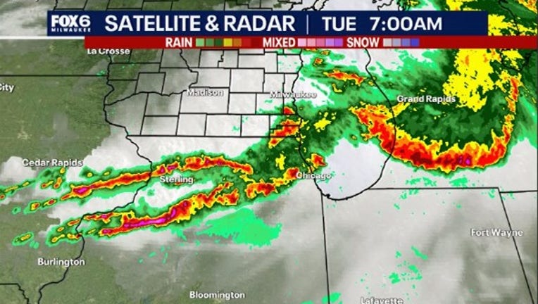
MILWAUKEE - Strong to severe thunderstorms moved through southeast Wisconsin on Tuesday morning, June 25.
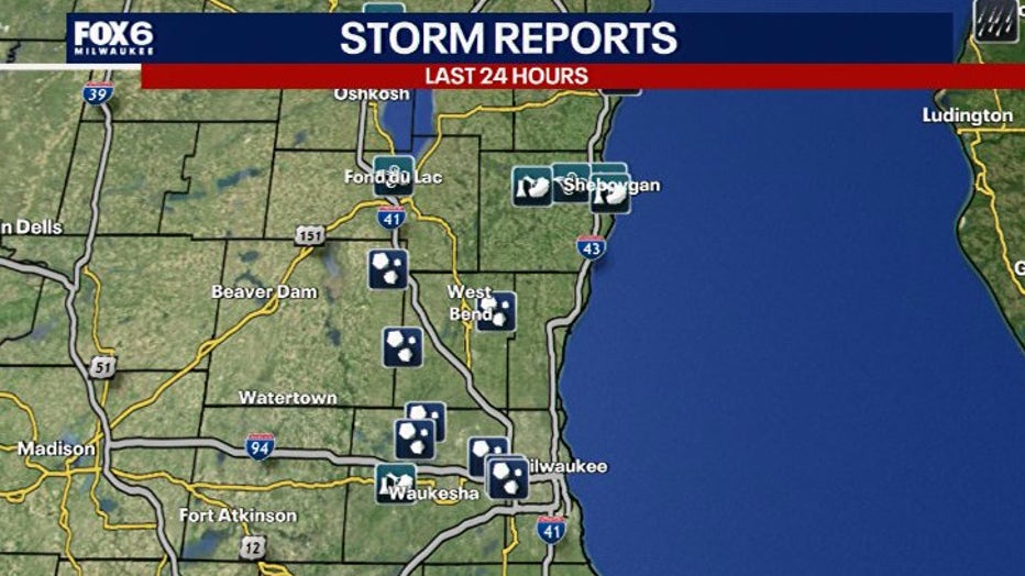
It came after five tornadoes were confirmed across the region during the night of Saturday, June 22. Wind reports were over 60 mph in parts of Sheboygan County, and there were plenty of hail reports along with heavy rainfall.
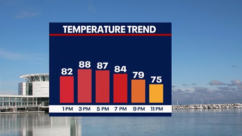
The FOX6 Weather Experts say, after an early round of strong to severe storms, things calm down Tuesday afternoon – but we could still see a few showers or storms late.
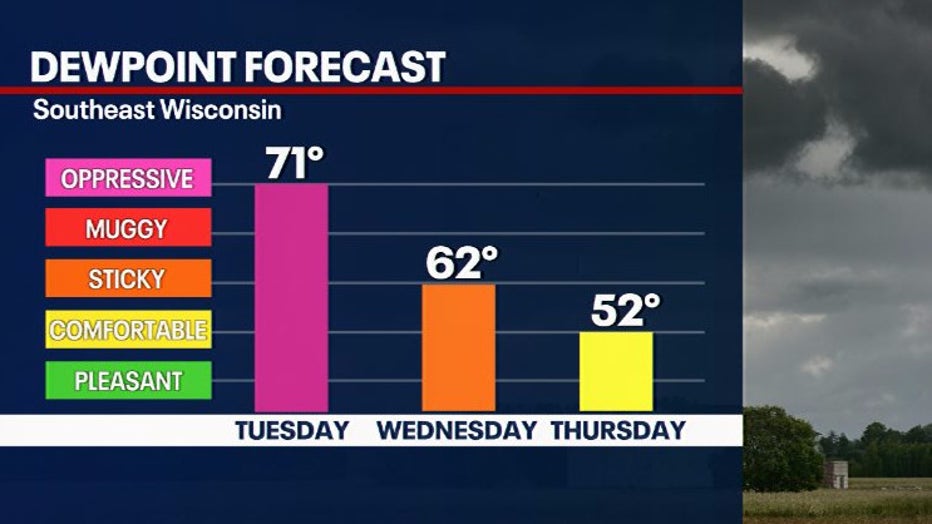
It'll also be hot and humid with highs in the 80s and low 90s Tuesday and dewpoints in the low 70s. Conditions will become more comfortable by Wednesday afternoon.
FOX6 Weather Extras
Meanwhile, FOX6Now.com offers a variety of extremely useful weather tools to help you navigate the stormy season. They include the following:
FOX6 Storm Center app

FOX6 News app
FOX Weather app
What is the FOX Model?

What is the FOX Model?
FOX Weather Expert Tom Wachs explains the value of the FOX Model for our team -- and our viewers.
FOX Weather
Maps and radar
We have a host of maps and radars on the FOX6 Weather page that are updating regularly — to provide you the most accurate assessment of the weather. From a county-by-county view to the Midwest regional radar and a national view — it’s all there.
School and business closings
When the weather gets a little dicey, schools and businesses may shut down. Monitor the latest list of closings, cancellations, and delays reported in southeast Wisconsin.

FOX6 Weather Experts in social media
- CLICK HERE to "Like" the FOX6 Weather Team on Facebook
- CLICK HERE to "Like" Rob Haswell on Facebook
- CLICK HERE to "Like" Tom Wachs on Facebook
- CLICK HERE to "Like" Stephanie Barichello on Facebook
- CLICK HERE to "Like" Lisa Michaels on Facebook
- CLICK HERE to "Follow" the FOX6 Weather Team on X
- CLICK HERE to "Follow" Rob Haswell on X
- CLICK HERE to "Follow" Tom Wachs on X
- CLICK HERE to "Follow" Stephanie Barichello on X
- CLICK HERE to "Follow" Lisa Michaels on X