Second round of dangerously cold air arrives Sunday morning
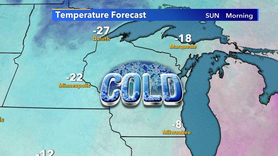
A second round of dangerously cold temps arrives Sunday morning, giving us another chance of double-digit negative temps for areas inland from the lake. The coldest Milwaukee has gotten this winter was -7°F on Sunday, Feb. 7 but we'll have multiple chances to get below that in the coming week.
Generally, Lake Michigan acts as a great insulator during the winter, it easily keeps cities near it almost 10°F warmer than spots farther west. But as the lake freezes over, this insulating effect weakens and within the past two weeks, we've gone from almost no ice coverage over Lake Michigan to nearly 20%.
On Sunday morning, Feb. 14 lows in Milwaukee are expected to reach -8°F but -15°F can occur farther west easily.

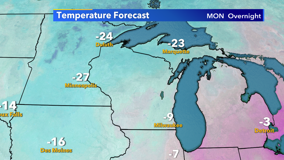
Monday morning, Feb. 15 looks to be just as cold as lows once again flirt with double-digit below 0° temperatures. All things considered, this round of arctic air will be longer lasting than what we had a week ago but there is warmer air on the horizon.

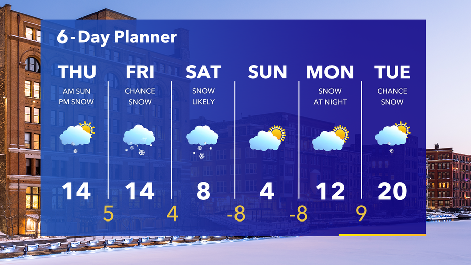
Southeast Wisconsin hasn't been above freezing since the beginning of February and that likely won't change for another couple of weeks but we do at least get to 20°F by Tuesday. Our average high continues to slowly increase through the month even though it might not feel like it we are reaching the end of winter.


