Strong to severe storms possible Wednesday afternoon, overnight
Late afternoon into the overnight Wednesday, July 14 strong to severe storms will be possible across southeast Wisconsin. These storms will be sustained thanks to strong upper-level winds and enough instability to cause multiple rounds of storms. READ MORE in the FOX6 Weather Forecast.
Round one is likely to move through the late afternoon into the evening with the main impacts being north of I-94. Model trends continue to push this initial line farther north but the timing has remained consistent.
Round two as of Wednesday morning, July 14 arrives late tonight into early Thursday morning. Damaging winds, heavy rain, and lightning are the main concerns.
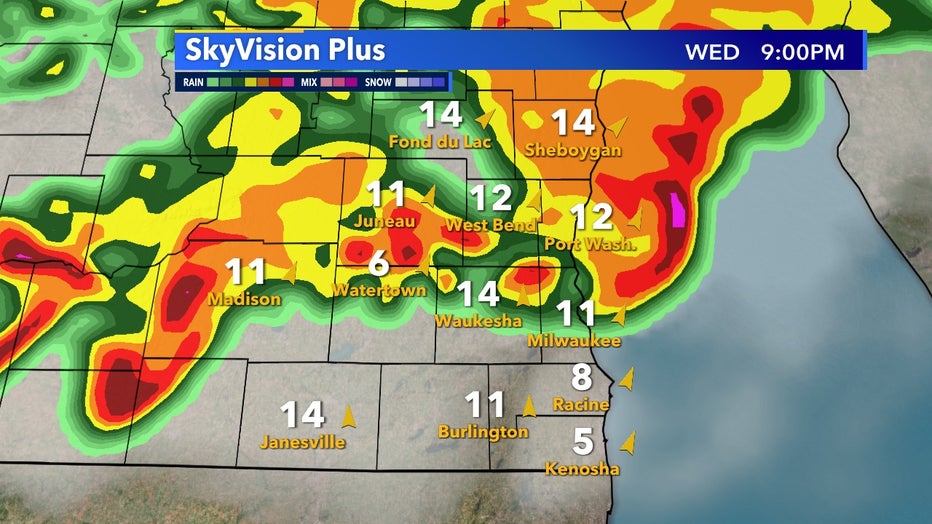
SkyVision Plus for Wednesday, July 14 9PM
A majority of Wisconsin is included in an enhanced risk which is a level 3 out of 5 severe threat. The severe outlook is slightly less far southeast – including Milwaukee, Racine, Kenosha, and Walworth counties.
Indicated in yellow, a slight risk is a level 2 out of 5, but isolated severe storms are still possible with these conditions.
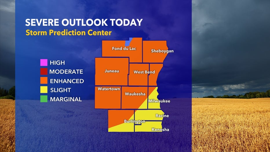
Sever outlook for Wednesday, July 14
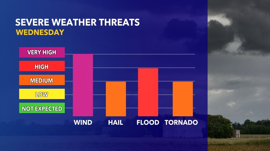
Breaking down the severe threats further, the biggest concern will be damaging winds. Gusts well over 50mph will be possible. Large hail and isolated tornado development are also possible as these storms move through.
Embedded within the two lines of storms will be heavy rain and could pose a flooding threat in areas of compacted soil and impermeable surfaces.