Tropical Storm Isaias continues to gain strength in the Caribbean, path takes eastern shift
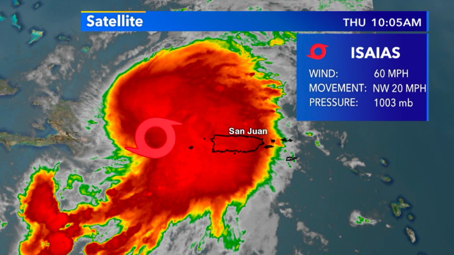
ATLANTIC OCEAN - Tropical Storm Isaias continues to gain strength in the Caribbean with sustained winds now at 60 mph. It continues a northwest track at roughly 20 mph and on Thursday morning, July 30 has landfall on the Dominican Republic.
Typically, over land tropical cyclones lose strength quite quickly but due to the size of this storm, a majority of the system will have plenty of warm water to sustain its strength.

Current satellite view of Isaias as of Thursday, July 30 10:05 a.m.
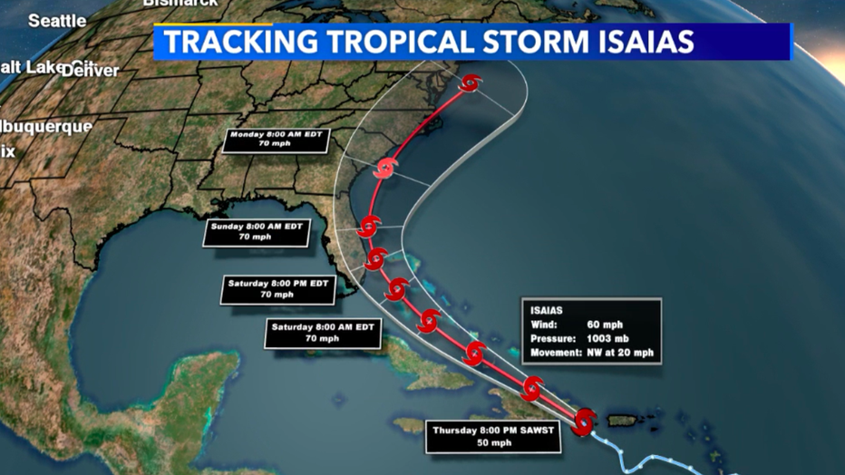
One major change in the forecast for the storm is the projected path. An eastern shift from yesterday's model data due to upper-level winds will now have the center of its forecasted route on the eastern portion of Florida, rather than the western part of Florida. While the future path can still change, this hints at a larger impact on the northeastern United States than the southeastern part of the country. If this holds true then Isaias does present the danger of riding the eastern seaboard all the way up into Canada.
Still, as of 11 a.m. on July 30, Isaias is not predicted to become a hurricane but its wind strength will get decently close by the time it arrives near Florida Saturday evening, Aug. 1. By the start of next week, it will likely be heading towards the Carolinas.
The big question mark is how long will it stay over warm water. This will potentially allow it to sustain its strength as a tropical storm all the way up to New Jersey.

Forecast path of Tropical Storm Isaias

