Wisconsin dreary stretch of weather; rain to be less impactful
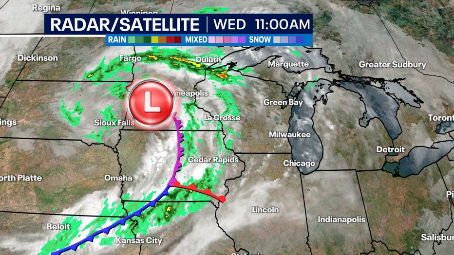
MILWAUKEE - Another slow-moving system enters the Midwest Wednesday afternoon, Oct. 18, and will impact Wisconsin's weather through Saturday, Oct. 21. But this time rain totals won't be as impressive.
Last week's rain panned out to be in the top five biggest rains of the year but also resulted in more than five days of dreary weather. This system will not cause nearly as much rain but will bring plenty of cloud cover.

Our next low pressure system giving us rain chances and clouds into Saturday, Oct. 21
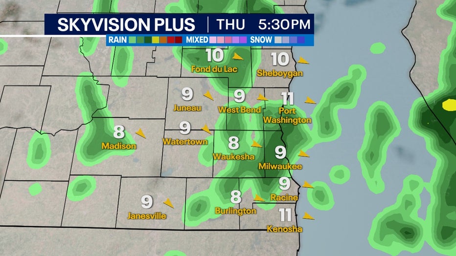
Spotty showers begin in the late afternoon on Wednesday, Oct. 18, and will continue into the end of the week. Most of the showers will be light with isolated periods of moderate rainfall. Intervals of cloudy skies and breezy winds can be expected for a majority of the time when you're not seeing rain.

SkyVision Plus for Thursday afternoon, Oct. 19
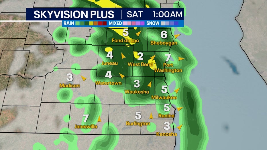
Saturday, Oct. 21 is the big variable of how much rain we'll see. If current model trends hold then it's possible northern counties could see prolonged moderate rainfall Saturday morning, Oct. 21 that slowly tapers off by the afternoon.
SIGN UP TODAY: Get daily headlines, breaking news emails from FOX6 News
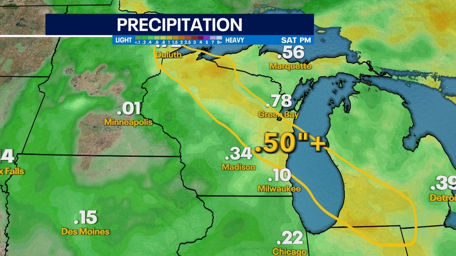
If this last hurrah of the system holds together, this could push rain totals above half an inch while others stay much lower.

SkyVision Plus for Saturday morning, Oct. 21
From Duluth, Minnesota to Kalamazoo, Michigan, much of northern Wisconsin and southwest Michigan is favored to see the highest rain totals from this system. As of now, Milwaukee is just a little too far south to see the benefits of a majority of the rainfall.
FREE DOWNLOAD: Get breaking news alerts in the FOX6 News app for iOS or Android
Thanks to recent rains and a wetter-than-average trend into the end of October drought concerns continue to ease as we head into fall.

Rain total forecast is highly variable depending on how Saturday morning's, Oct. 21 rain sets up

