

SE Wisconsin scattered severe storms bring hail
SE Wisconsin scattered severe storms bring hail
Scattered severe thunderstorms impacted parts of southeastern Wisconsin on Thursday. Hail was reported in Milwaukee County with a cell that moved through during the evening.
MILWAUKEE - Scattered severe thunderstorms impacted parts of southeastern Wisconsin on Thursday, April 20. Hail was reported in Milwaukee County with a cell that moved through during the evening.
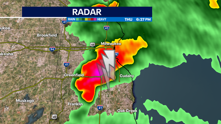
Milwaukee County radar image from Thursday evening.
Another severe thunderstorm brought the potential for hail to parts of eastern Fond du Lac and northwestern Sheboygan County, as well.
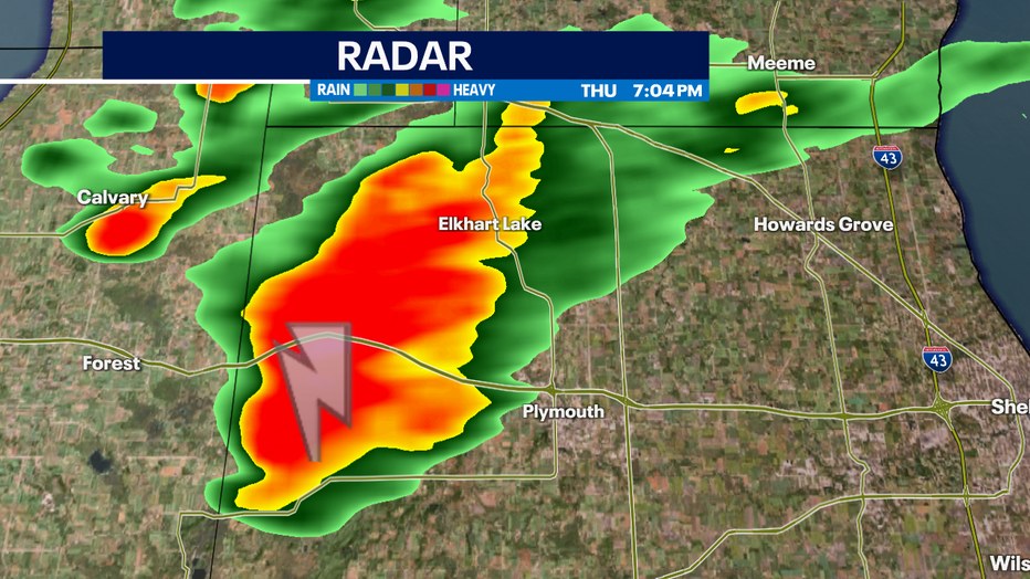
Sheboygan County radar from Thursday evening.
As of 7:30 p.m., all watches and warnings were canceled.
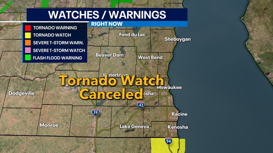
All watches and warnings were canceled by 7:30 p.m. Thursday.
After only reaching the 40s on Wednesday, Milwaukee surged into the upper 70s on Thursday as a warm front moved through. The warmer air caused instability in the atmosphere. As a cold front approached by evening, showers and thunderstorms developed in parts of Illinois and stretched into Wisconsin.
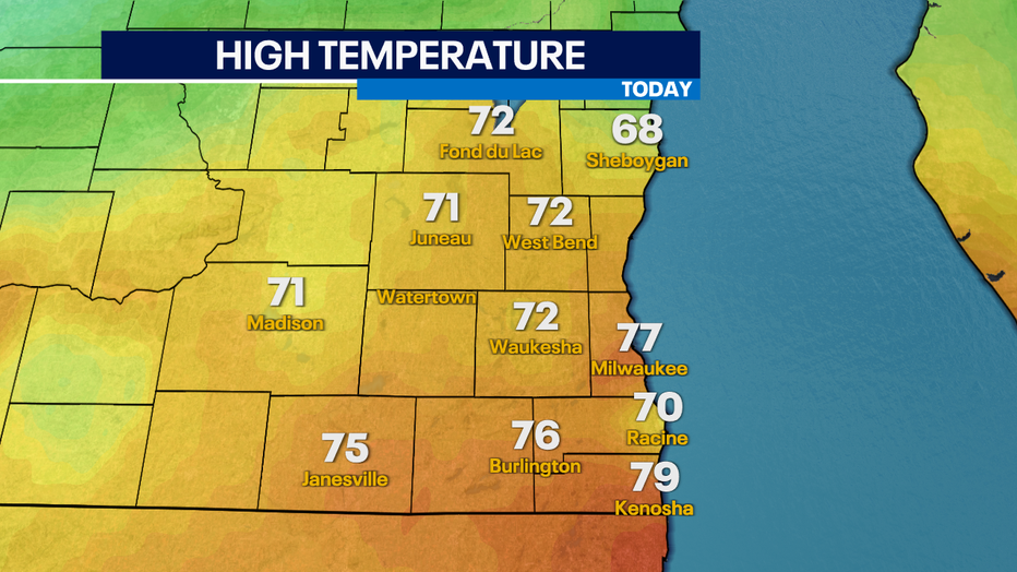
High Temperatures Thursday
Here are viewer photos of hail from the storms and a beautiful rainbow after the storm came through:
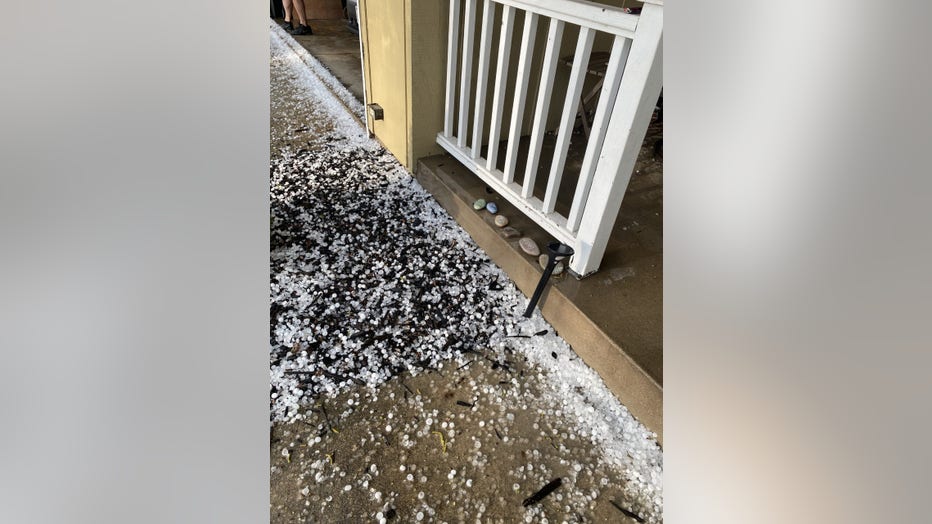
Hail from Dawn in Greenfield
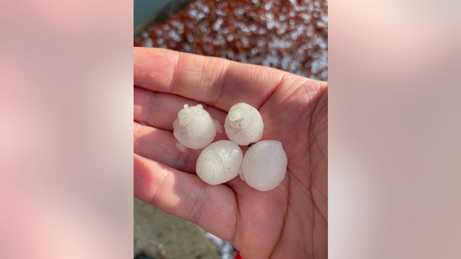
Hal from Dennis in South Milwaukee

Hail from Alan in Greendale
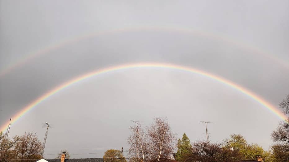
Double Rainbow from Stacey in South Kenosha

Kenosha Rainbow from Eric
FOX6 Weather Extras
FOX6Now.com offers a variety of extremely useful weather tools to help you navigate the stormy season. They include the following:
FOX6 Storm Center app

FOX6 News app
FOX Weather app
MAPS AND RADAR
We have a host of maps and radars on the FOX6 Weather page that are updating regularly — to provide you the most accurate assessment of the weather. From a county-by-county view to the Midwest regional radar and a national view — it’s all there.
SCHOOL AND BUSINESS CLOSINGS
When the weather gets a little dicey, schools and businesses may shut down. Monitor the latest list of closings, cancellations, and delays reported in southeast Wisconsin.

FOX6 WEATHER IN SOCIAL MEDIA
- CLICK HERE to "Like" the FOX6 Weather Team on Facebook
- CLICK HERE to "Like" Rob Haswell on Facebook
- CLICK HERE to "Like" Tom Wachs on Facebook
- CLICK HERE to "Like" Stephanie Barichello on Facebook
- CLICK HERE to "Like" Eric Manges on Facebook
- CLICK HERE to "Like" Lisa Michaels on Facebook
- CLICK HERE to "Follow" the FOX6 Weather Team on Twitter
- CLICK HERE to "Follow" Rob Haswell on Twitter
- CLICK HERE to "Follow" Tom Wachs on Twitter
- CLICK HERE to "Follow" Stephanie Barichello on Twitter
- CLICK HERE to "Follow" Eric Manges on Twitter
- CLICK HERE to "Follow" Lisa Michaels on Twitter