Wisconsin warm, dry weather conditions in September 2024
MILWAUKEE - Meteorological Fall began Sept. 1 and typically when we think of fall, cooler temperatures come to mind, but not this season. The majority of September so far has been above average with high temperatures in the 80s.

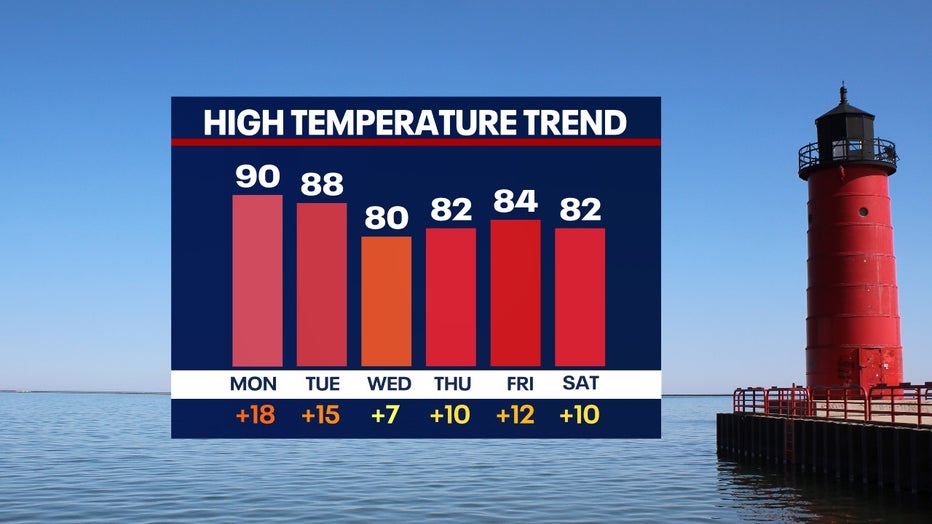
In terms of cooler temperatures, long-range forecast models do not show any cool down in sight. Over the next six days, high temps are expected to stay in the 80s. This means most days will be in the range of 10°+ above average.
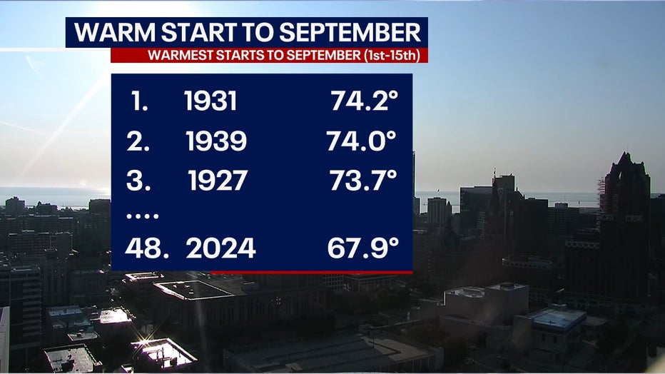
While we are experiencing unseasonably warm temperatures this fall, Milwaukee does not have one of the warmest starts in September. So far this year, Milwaukee has the 48th warmest start in the record books from Sept. 1 through Sept. 15.
SIGN UP TODAY: Get daily headlines, breaking news emails from FOX6 News
The Climate Prediction Center projects the Midwest to be above average in the temperature department for six to ten days out, Sept. 21-25 and and 8-14 days out, Sept. 23-29. This could easily bump up our placement for one of the warmest Septembers by the end of the month.
Temperatures this time of year typically should be in the mid-70s and transition into the upper 60s by the end of September.
FREE DOWNLOAD: Get breaking news alerts in the FOX6 News app for iOS or Android

With many more warm days in the forecast, we are also looking for more dry days to follow as well. Unfortunately, this is not good news for southern Wisconsin as more areas are already under abnormally dry conditions.
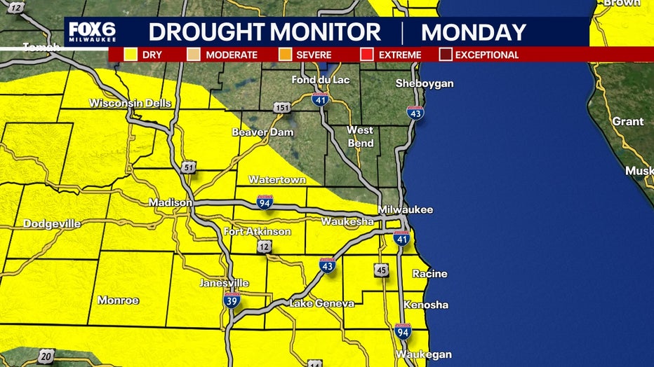
Another prolonged dry period looms across southeast Wisconsin over the next six days.
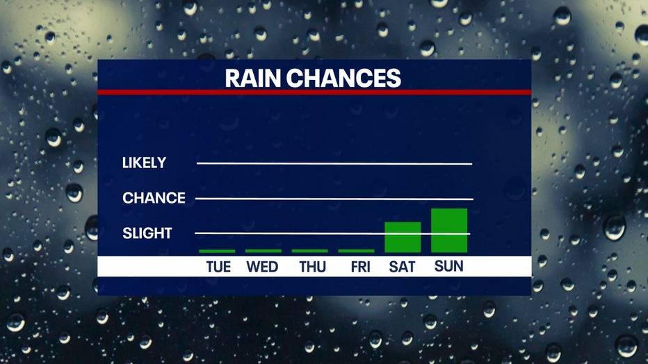
There is a slight chance of rain over the weekend, but this too may be pushed back until Tuesday, Sept. 24. The lack of rain will likely add more areas to abnormally dry conditions and/or a moderate drought for southern areas of the state.
While this year has been wet overall with a surplus of 5"+ of rain, we are taking a turn into a dry period with a deficit of 1.5"+ of rain this month.
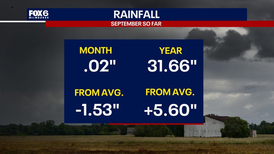
This dry start to September places Milwaukee at the fourth-driest start to meteorological fall. As a blocking pattern in the atmosphere becomes dislodged over the next two weeks, we should see rain and storms back in the forecast prior to the end of the month.

