

SE Wisconsin blizzard warning canceled; winter weather advisory in effect

MILWAUKEE - UPDATE: The National Weather Service has canceled the blizzard warning for all of southeast Wisconsin and replaced it with a winter weather advisory.
Latest weather alerts
What we know:
The National Weather Service has all of southeast Wisconsin to a blizzard warning until 4 p.m. Monday.
Strong winds gusting up to 40–50 mph and moderate to heavy snow will create low visibility a quarter mile or less. Use extreme caution if driving, and it is advised to stay off of the roads if possible.
A blizzard warning isn't defined by the amount of snow, but rather sustained winds of 35mph or frequent gusts higher, causing blowing or falling snow to reduce visibility to a quarter of a mile or less for three hours or more.

The last time all of southeast Wisconsin was under a blizzard warning was the 2011 Groundhog Day Blizzard.
Only five such warnings have been issued for the region (six including the one issued Sunday) since 2011 – and it's the first for Milwaukee County since 2011.
Milwaukee County Executive David Crowley, in conjunction with the county's Office of Emergency Management, declared a snow emergency for Monday.
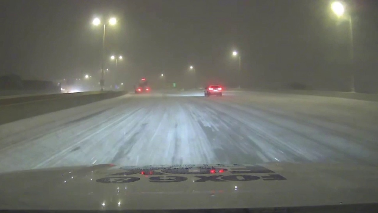
Messy morning commute as blizzard continues
Strong winds and heavy snow create low visibility Monday morning; use caution when driving.
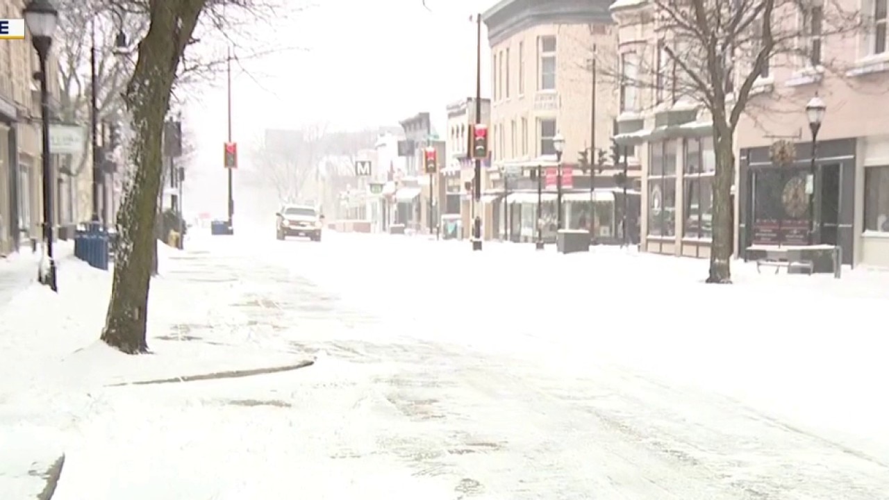
Snowy conditions impacting Waukesha
A powerful late-season winter storm is hammering southern Wisconsin, Bret Lemoine has a look at the conditions in Waukesha.
Editor's note: This is a breaking news update. The information below was last updated at 5 p.m. Sunday. Watch the livestream above for the latest information
Areas in Wisconsin experienced such heavy snow on Sunday that the Wisconsin Department of Transportation was advising people not to travel on the roads. Near Wausau, plowing crews had to stop due to dangerous visibility.
Storm conditions in Milwaukee's east side
Blizzard warning for all of southeast Wisconsin on Monday. Brian Kramp has a look at the weather conditions on Milwaukee's east side.
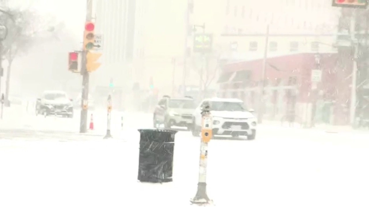
Road conditions across Wisconsin as of Monday morning are not great.

A large portion of the state has treacherous road conditions where traveling is not advised. Southern Wisconsin has slippery or completely covered roads.
Monday Outlook
What we know:
Widespread snow will continue to cause snow to accumulate quickly with rates that could reach 1" an hour.
The backside of this system will gradually start to move east, diminishing snow by the afternoon on Monday. While snow should be out by the evening hours, there will still be blowing snow due to the high winds lingering around.
Check out the FOX6 Weather Alerts page for the most recent updates.
Stay tuned to your FOX6 Weather Experts for additional updates!
FOX6 Weather Extras
Local perspective:
Meanwhile, FOX6Now.com offers a variety of extremely useful weather tools to help you navigate the stormy season. They include the following:
FOX6 Storm Center app

FOX LOCAL Mobile app
FOX Weather app
What is the FOX Model?

What is the FOX Model?
FOX Weather Expert Tom Wachs explains the value of the FOX Model for our team -- and our viewers.
FOX Weather
Maps and radar
We have a host of maps and radars on the FOX6 Weather page that are updating regularly — to provide you the most accurate assessment of the weather. From a county-by-county view to the Midwest regional radar and a national view — it’s all there.
School and business closings
When the weather gets a little dicey, schools and businesses may shut down. Monitor the latest list of closings, cancellations, and delays reported in southeast Wisconsin.

FOX6 Weather Experts in social media
- CLICK HERE to "Like" the FOX6 Weather Team on Facebook
- CLICK HERE to "Like" Rob Haswell on Facebook
- CLICK HERE to "Like" Tom Wachs on Facebook
- CLICK HERE to "Like" Stephanie Barichello on Facebook
- CLICK HERE to "Like" Lisa Michaels on Facebook
- CLICK HERE to "Like" Holly Baker on Facebook
- CLICK HERE to "Follow" the FOX6 Weather Team on X
- CLICK HERE to "Follow" Rob Haswell on X
- CLICK HERE to "Follow" Tom Wachs on X
- CLICK HERE to "Follow" Stephanie Barichello on X
- CLICK HERE to "Follow" Lisa Michaels on X
- CLICK HERE to "Follow" Holly Baker on X
The Source: This story was produced by the FOX6 Weather Experts with information from the Storm Protection Center and the National Weather Service.