

Wisconsin storm damage: Tornado, flood fallout from Friday weather
Wisconsin deals with aftermath of severe storms
Across southeast Wisconsin, communities are dealing with the aftermath of Friday night's severe storms. FOX6 News found damage and flooding in Franklin, Caledonia and other areas Saturday.
MILWAUKEE - Southeast Wisconsin experienced more tornadoes and flooding from severe thunderstorms on Friday night, the fourth and final round of an intense and damaging week of weather for the area.
What's next:
The threat of any severe weather has now passed for the immediate future, with no storms or rain expected for several days. Several rivers are at flood stage, and there are multiple river flood warnings in effect over the next few days.
FREE DOWNLOAD: Get breaking news alerts in the FOX LOCAL Mobile app for iOS or Android
When the sun rose Saturday, southeast Wisconsin began dealing with widespread damage and floods. FOX6 News surveyed the area and spoke with residents who are now picking up the pieces.
PHOTO GALLERY: Aftermath of April 17 storms
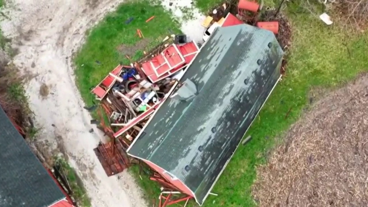
Caledonia greenhouse crushed
What they're saying:
The owner of L and L Farms said storms crushed a greenhouse that had $20,000 worth of items inside. The weather also damaged a barn roof and caused a tree to fall onto a house. Family and friends helped each other recover.
Storm damage in Caledonia
Friday's storms left quite the mark across southern and southeastern Wisconsin, including at L and L Farms and Greenhouse in Caledonia.
Oak Creek flooding
What they're saying:
Major flooding almost literally left homes on an island, and high water levels left a section of County Line Road underwater near the Root River.
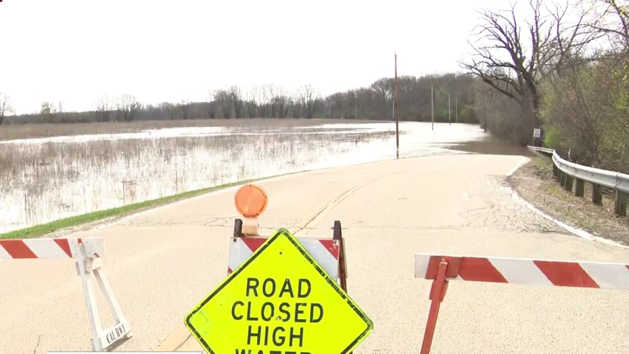
Flooding and high river levels throughout SE Wisconsin
Now that the storms have passed, it's flooding and high river levels that are the big concern. FOX6's Andrew Amouzou is in Oak Creek where the Root River has flooded and forced a road closure.
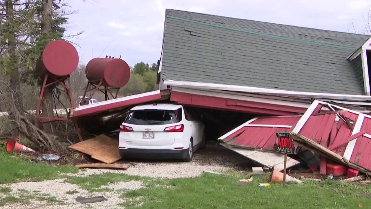
Franklin barn collapse
What they're saying:
A family picked up the pieces – a blown-off roof, downed trees and more – after storms damaged a farmstead off of 76th Street. Four structures on the property were damaged, but one of the barns completely collapsed in the storm.
Shattered glass and planks of wood lie where the barn once stood. It fell on top of a resident's car, who told FOX6 News she had moved it inside in hopes of avoiding hail damage.
SIGN UP TODAY: Get daily headlines, breaking news emails from FOX6 News
"Franklin's a wonderful community. Our friends, everybody that's willing to come out and help at any given time – it's unbelievable," Tracy Holterman, the property owner, said.
The owners said the next step is insurance; an adjuster came out Saturday and will be back Monday. They hope to start their planting season soon.

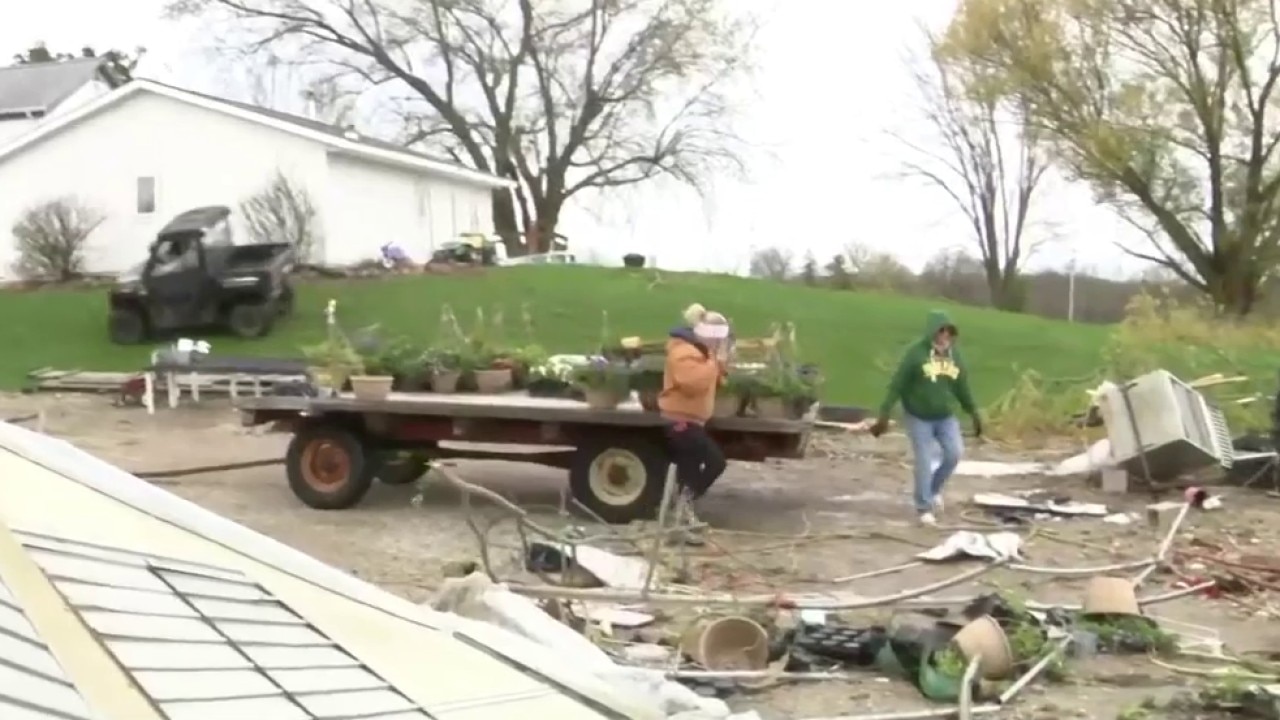
On the farm following the severe storms
FOX6's Hayley Spitler stopped at a farm in Franklin that suffered damage from Friday's night's severe storms and spoke to the farm's owner.
Farmstead damage in Franklin
FOX6's Hayley Spitler is in Franklin on Saturday morning, April 18, getting a daylight look at the damage from last night's storms.
Tornadoes confirmed
By the numbers:
The National Weather Service confirmed seven tornadoes touched down in southeast Wisconsin on Friday night, April 17. One, which had maximum wind speeds estimated at 100 mph, crossed the Milwaukee-Racine County line. The Racine County and Walworth County areas saw the most.
Fox River in Burlington
Local perspective:
After several rounds of severe thunderstorms dumped inches of rain throughout the week, Burlington is among the communities across southeast Wisconsin dealing with flooding on Saturday. The Fox River overflowed, bursting into neighborhoods after several days of severe weather.
Assistance for residents is available through the city, county and others.
Rock River in Jefferson
Local perspective:
The NWS issued a flood warning for the Rock River at Jefferson. Water levels are predicted to rise from the previous prediction of 12.4 feet in the moderate flood stage, to 12.9 feet by April 23 – just below the major flood stage of 13 feet. It is then predicted to stay at that level through April 25.
East Riverview Drive was closed due to high water on the roadway near the Tensfeldt Park boat launch and the wastewater treatment plant on Saturday. The West North Street walk bridge was closed due to high water and debris accumulation.
All sump pump discharges should be directed to lawns and should not be directed to floor drains to reduce impacts on the wastewater treatment plant.
All city boat launches and fishing piers remain closed, and a full closure of Riverfront Park was anticipated due to standing floodwaters. City officials urge people to be patient when traveling, avoid areas of standing water, and never drive through a flooded roadway.
The City of Jefferson has sandbag material for use at 425 Collins Road. City residents are responsible for filling and placing sandbags on their property, and they are encouraged to take precautionary measures. If your property is in a low-lying area in the floodplain, plan ahead accordingly. Imminent threats of floodwater can be reported to City Hall or the Jefferson Police Department.
- City Hall: Monday – Thursday, 8 a.m. – 4:30 p.m. | Friday, 8 a.m. – 3 p.m. | 920-674- 7700
- Police Department: Monday – Friday, 7 a.m. – 11 p.m. | 920-674-7707
- Police Department: Saturday, 7 a.m. – 3 p.m. | 920-674-7707
- Emergency: Call 911
FOX6 Weather Extras
Local perspective:
Meanwhile, FOX6Now.com offers a variety of extremely useful weather tools to help you navigate the stormy season. They include the following:
FOX6 Storm Center app

FOX LOCAL Mobile app
FOX Weather app
Maps and radar
We have a host of maps and radars on the FOX6 Weather page that are updating regularly — to provide you the most accurate assessment of the weather. From a county-by-county view to the Midwest regional radar and a national view — it’s all there.
SIGN UP TODAY: Get daily headlines, breaking news emails from FOX6 News
School and business closings
When the weather gets a little dicey, schools and businesses may shut down. Monitor the latest list of closings, cancellations, and delays reported in southeast Wisconsin.

FOX6 Weather Experts in social media
- CLICK HERE to "Like" the FOX6 Weather Team on Facebook
- CLICK HERE to "Like" Rob Haswell on Facebook
- CLICK HERE to "Like" Tom Wachs on Facebook
- CLICK HERE to "Like" Stephanie Barichello on Facebook
- CLICK HERE to "Like" Lisa Michaels on Facebook
- CLICK HERE to "Like" Holly Baker on Facebook
- CLICK HERE to "Follow" the FOX6 Weather Team on X
- CLICK HERE to "Follow" Rob Haswell on X
- CLICK HERE to "Follow" Tom Wachs on X
- CLICK HERE to "Follow" Stephanie Barichello on X
- CLICK HERE to "Follow" Lisa Michaels on X
- CLICK HERE to "Follow" Holly Baker on X
The Source: FOX6 News referenced information from the National Weather Service and FOX6 Weather Experts.