

Wisconsin severe weather: Flood watch canceled, thousands without power
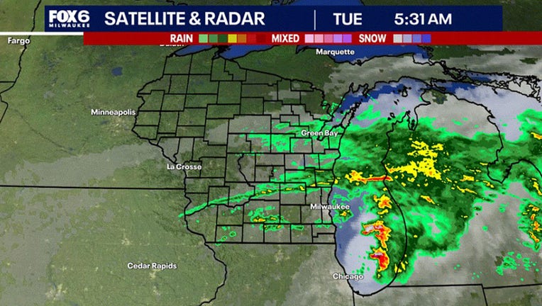
MILWAUKEE - The flood watch has been canceled for southeast Wisconsin, although spotty showers and storms will continue on Tuesday morning, Aug. 6.
The heavy rain mostly tracked across Iowa, Dane, Green, Rock, and Jefferson Counties. Many areas received well over an inch.
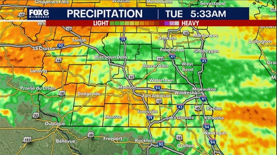
The rainfall amounts were less than expected but still significant. The FOX6 Weather Experts say after the rain and thunderstorms wind down Tuesday morning we will see partly sunny conditions and stay dry for a few days.
Strong wind gusts were common during the passing storms, with gusts near 50mph in some areas. The storms knocked out power for thousands of We Energies customers. As of 5:50 a.m. on Tuesday, the We Energies Outage Map showed more than 11,000 outages in southeast Wisconsin.
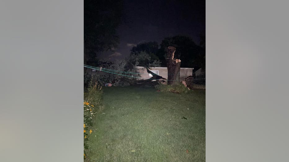
Some tree damage was reported on Tuesday night and early Wednesday morning. This picture was shared by Bonnie M. in Watertown, WI.
We will be much cooler today with highs in the upper 60s and low 70s.
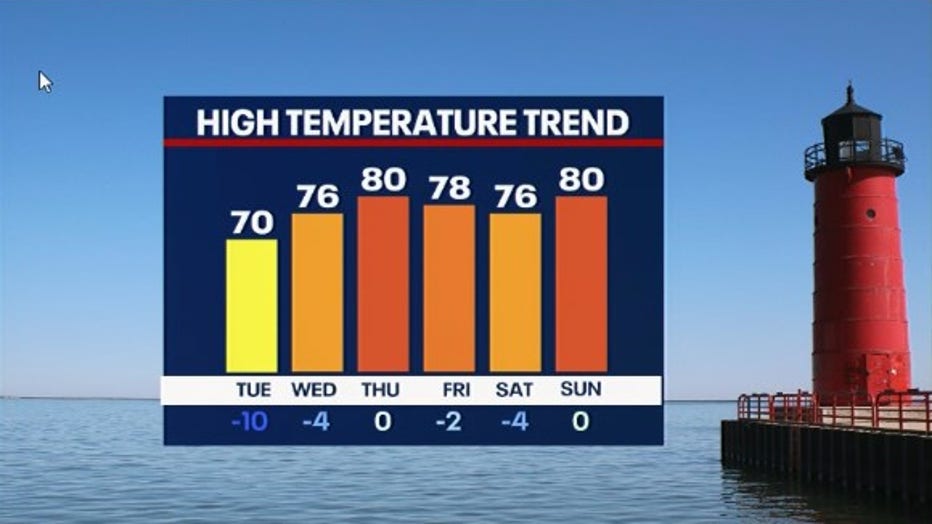
A few dry days ahead with a stretch of cooler than average temperatures. Highs will be in the upper 70s to near 80 from Wednesday through Sunday.
Our next significant chance for rain might not come until late next week.
FOX6 Weather Extras
Meanwhile, FOX6Now.com offers a variety of extremely useful weather tools to help you navigate the stormy season. They include the following:
FOX6 Storm Center app

FOX6 News app
FOX Weather app
What is the FOX Model?
FOX Weather
Maps and radar
We have a host of maps and radars on the FOX6 Weather page that are updating regularly — to provide you the most accurate assessment of the weather. From a county-by-county view to the Midwest regional radar and a national view — it’s all there.
School and business closings
When the weather gets a little dicey, schools and businesses may shut down. Monitor the latest list of closings, cancellations, and delays reported in southeast Wisconsin.

FOX6 Weather Experts in social media
- CLICK HERE to "Like" the FOX6 Weather Team on Facebook
- CLICK HERE to "Like" Rob Haswell on Facebook
- CLICK HERE to "Like" Tom Wachs on Facebook
- CLICK HERE to "Like" Stephanie Barichello on Facebook
- CLICK HERE to "Like" Lisa Michaels on Facebook
- CLICK HERE to "Follow" the FOX6 Weather Team on X
- CLICK HERE to "Follow" Rob Haswell on X
- CLICK HERE to "Follow" Tom Wachs on X
- CLICK HERE to "Follow" Stephanie Barichello on X
- CLICK HERE to "Follow" Lisa Michaels on X